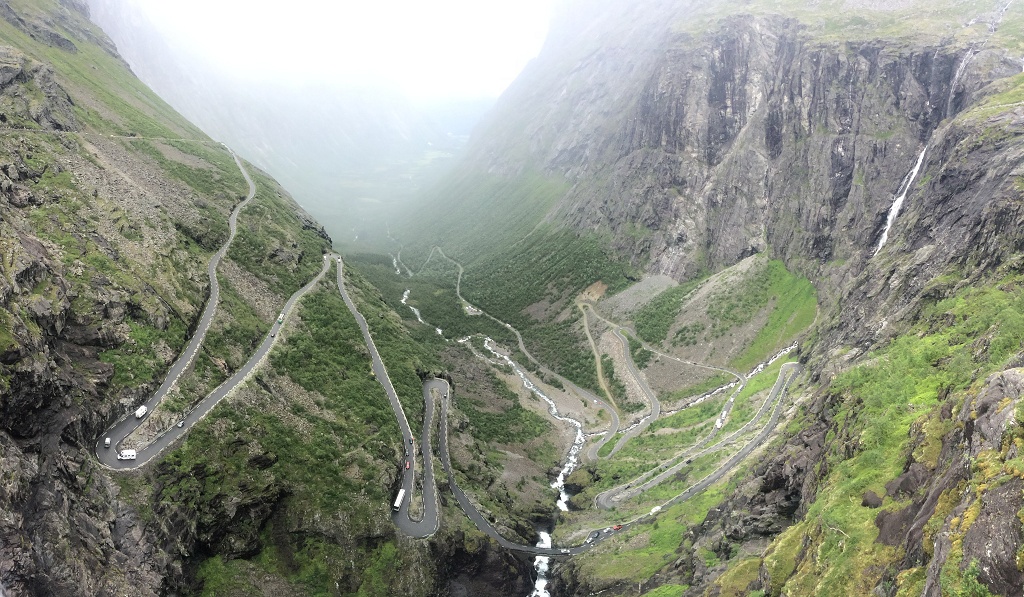
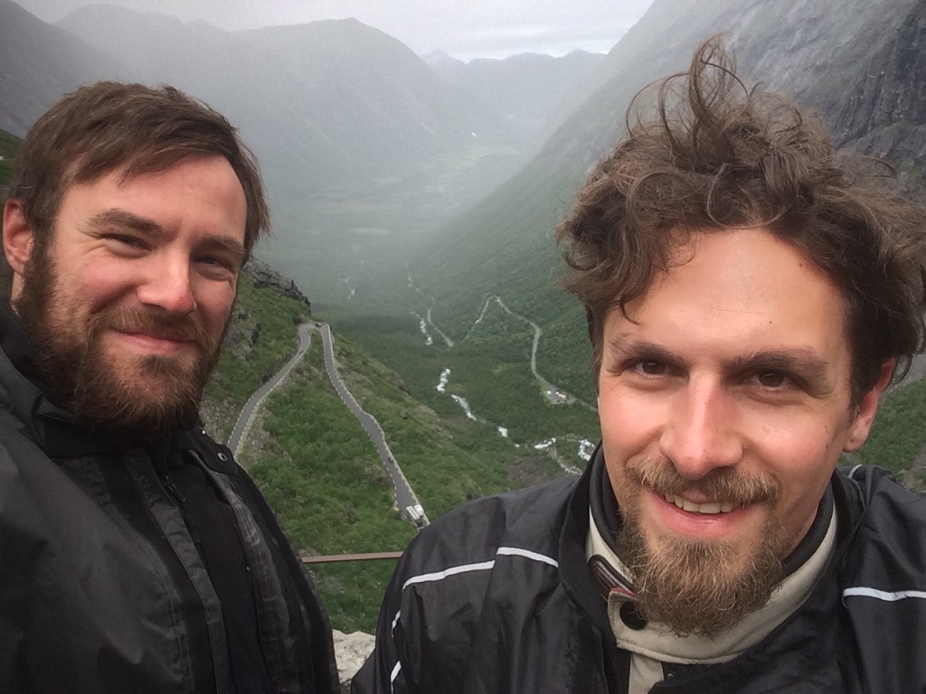
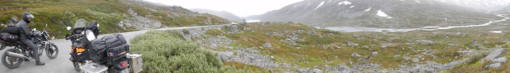
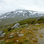
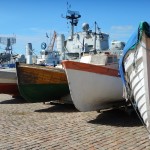
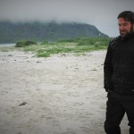
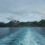
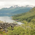
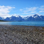
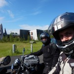
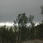
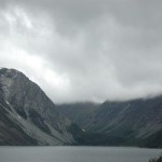
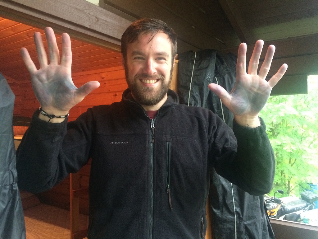
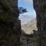
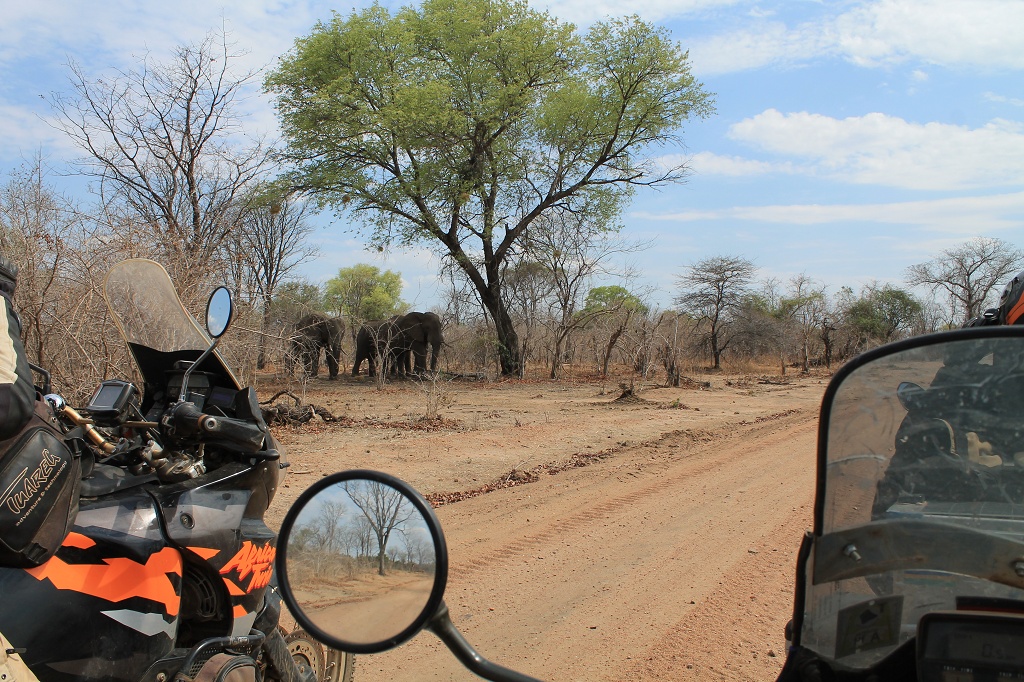
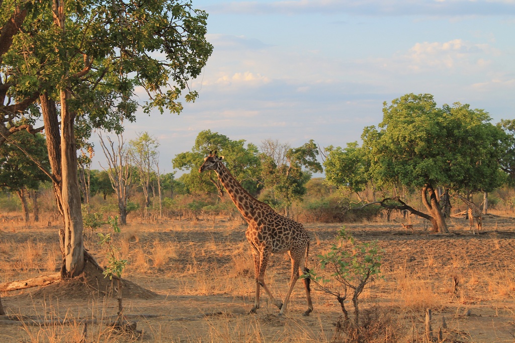
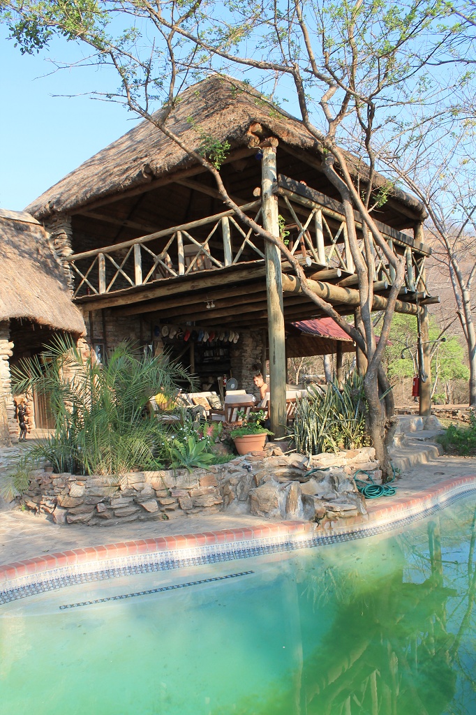
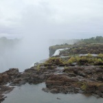
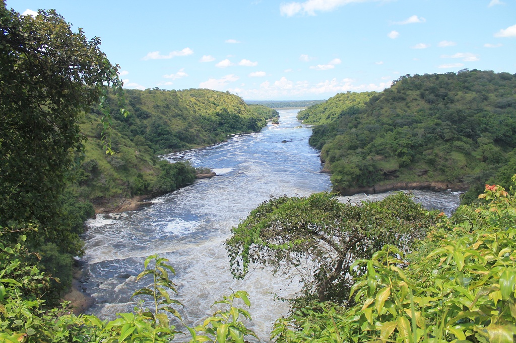
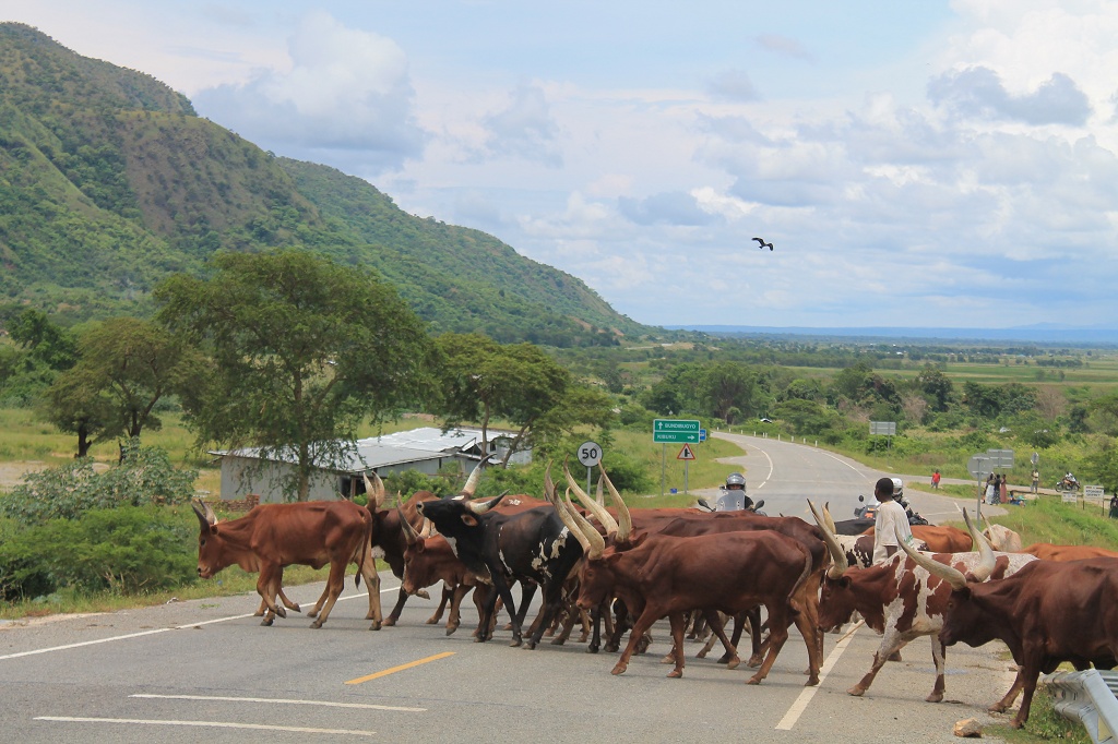
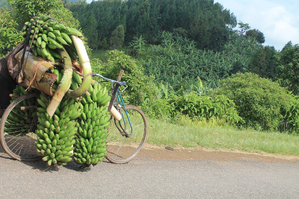
The last two weeks had been a great experience with lots of fun and a hand full of challenges. Sadly our trip needs to come to an end and as we woke up that day we realized, we had only a couple of days left. But before we would ride the main roads and highways to get home, a day full of mountain passes, dirt roads and fjords was just waiting for us around the corner. One of the most famous serpentine mountain roads of Norway is the Trollstigen. The 18 km long pass ascends for 405 m with a slope of 12% and has eleven hairpin bends. Sounds like made for the bikes, if it hadn’t been for all the busses and caravans. The road is so narrow that there a plenty of spots where they can’t pass each other and you have to wait till they figure it out. Anyway it was a good fun to ride and a great view from the top.
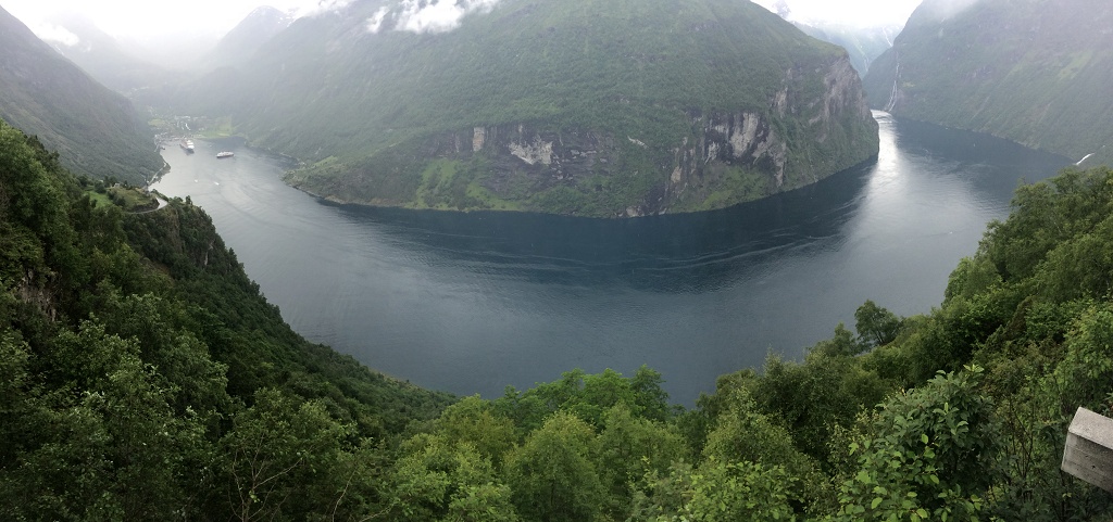
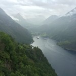
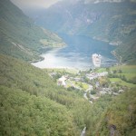
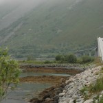
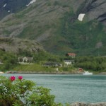
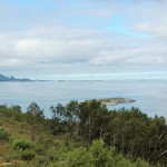
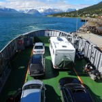
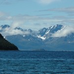
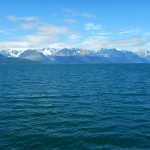
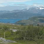
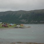
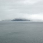
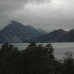
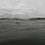
We carried on to the town of Linge, where we crossed the Norddalsfjorden with a ferry. Further along the 63 we passed several mountain passes till we reached the Geirangerfjorden, another admirable touristic highlight.
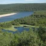
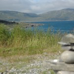
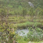
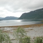
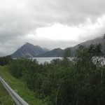
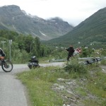
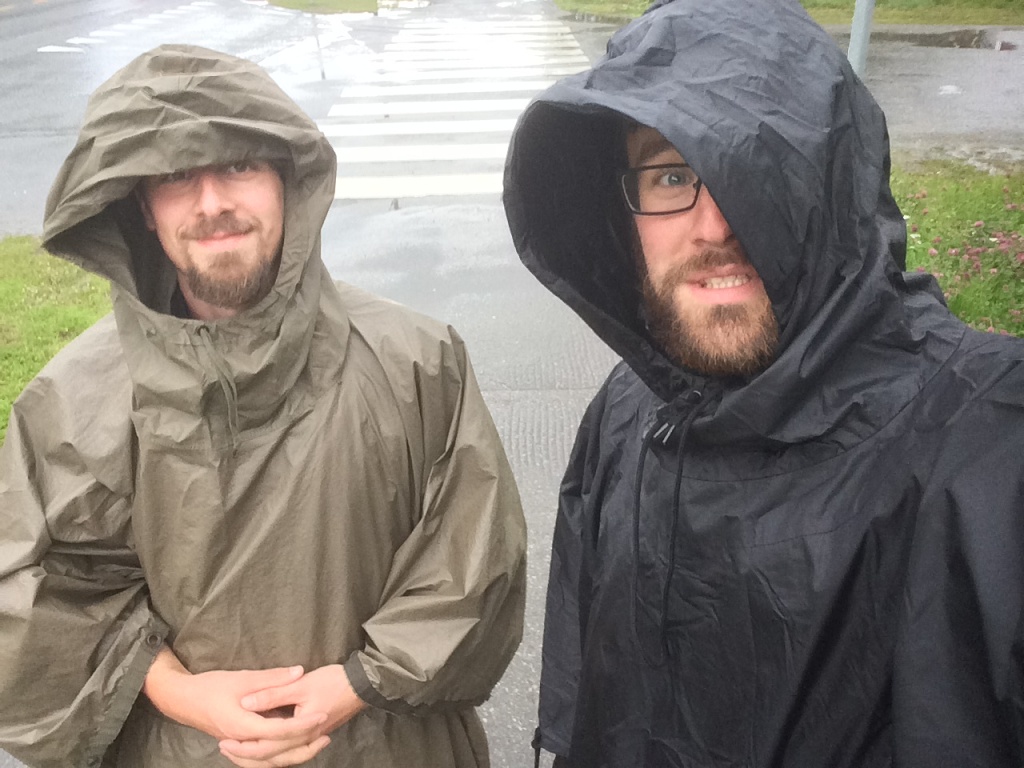
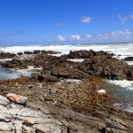
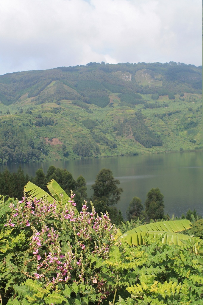
Next on the list was a detour to a dirt road, Marianne had told us about. The road led through the mountainside and it was really wonderful. Well the rain was a little drawback, cause it had made the road a bit slippery and it was freaking cold ;P It was a great completion of our ride and I am very happy that we got a glimpse of the scenery of southern Norway.
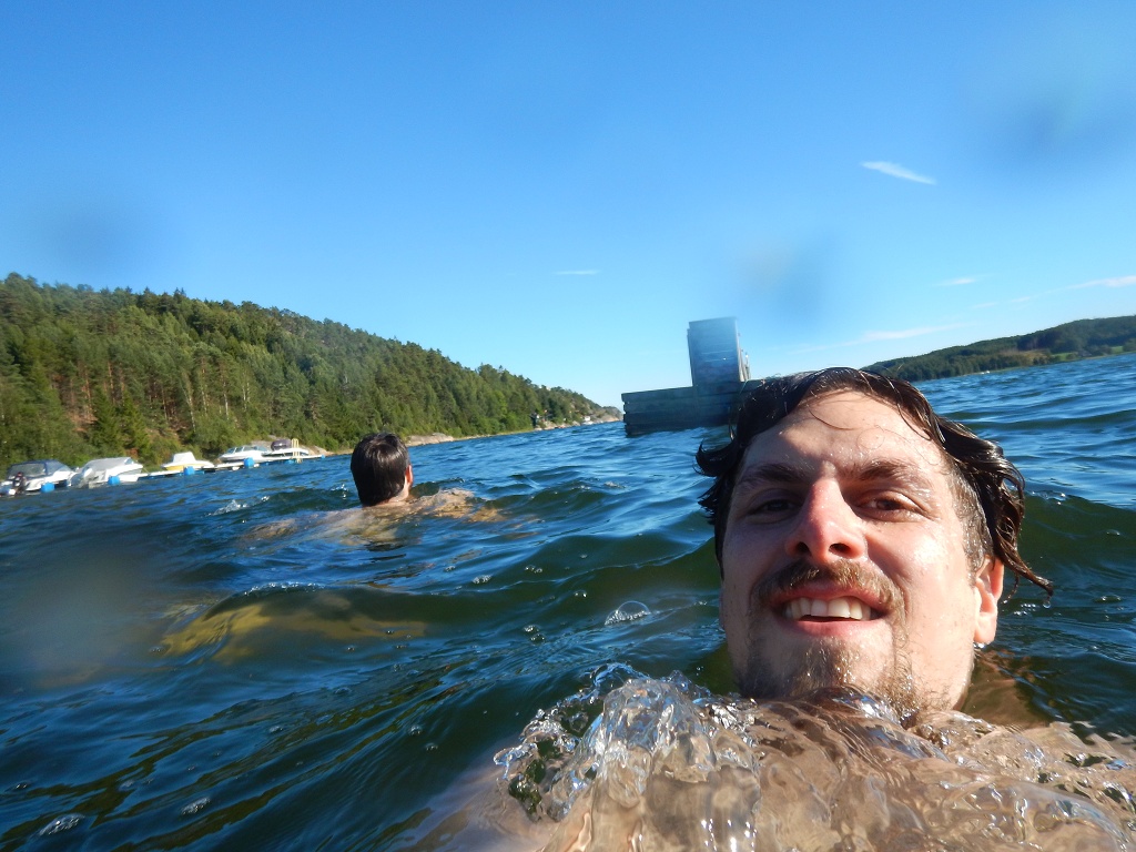
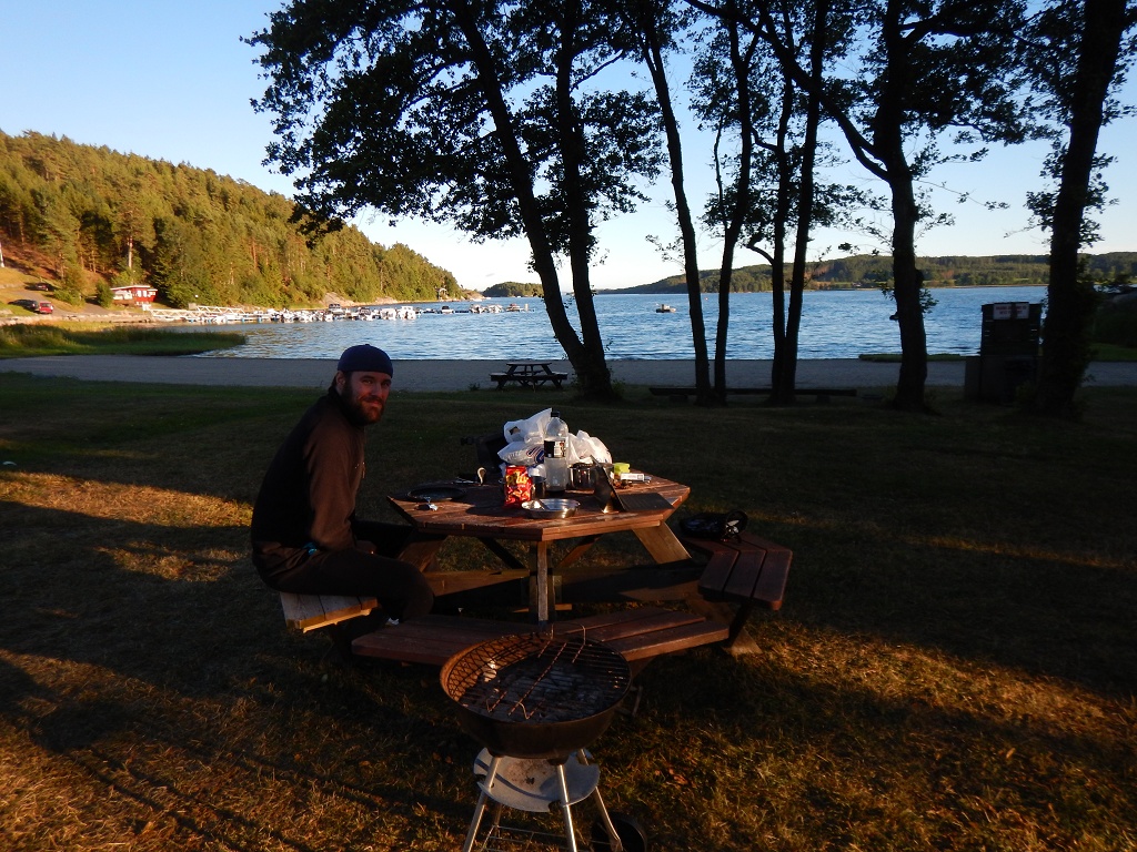
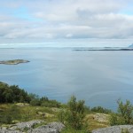
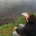
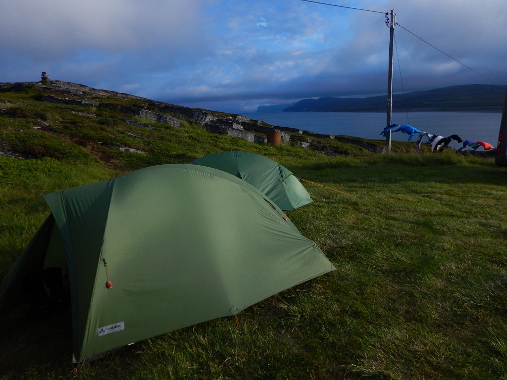
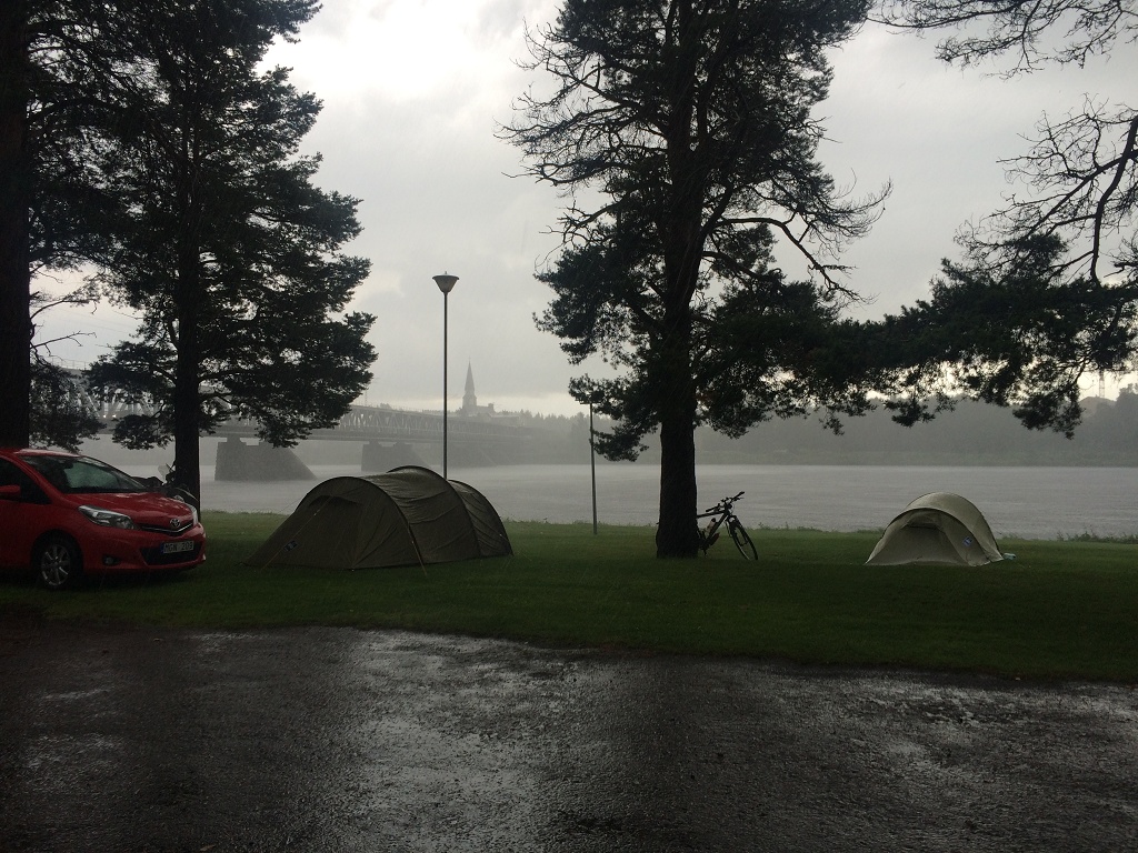
We spent the night on a campsite in Aurdal. Our plan for the upcoming day was to make a short relaxing ride to a campsite near to the swedish border, settle down early and go fishing. Passing Oslo and Frederikstad, there are some beautiful small islands which just seemed to be perfect for that. They were indeed gorgeous and obviously the holiday destination of complete Norway. We spent hours looking for a free spot. Finally we found a campsite in Revebukta. It was already too late for fishing or at least we weren’t in the mood anymore. Instead we went for a refreshing swim 🙂
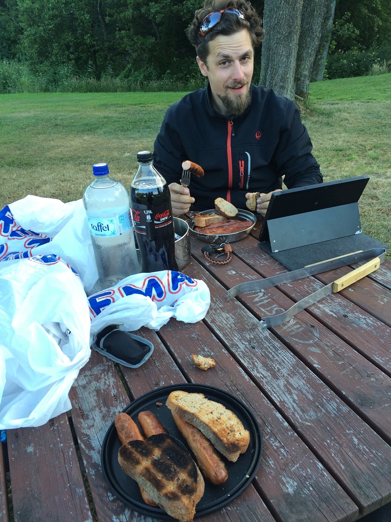
Just as we had started to prepare our gasoline stove for a fancy pasta dinner, our neighbor came to us. She said: “We are leaving tomorrow!” We looked at each other and replied “Okay”. 😛 Then she told us that they had ten sausages and a hot barbeque left and asked if we would like to have it. Well hell yeah, thank you very much, sausage feast it was. Someone else gave us a bottle of coke, what nice people. I really hope we were not looking that devastated :p
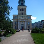
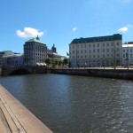
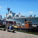
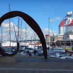
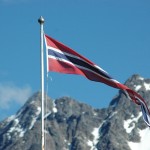
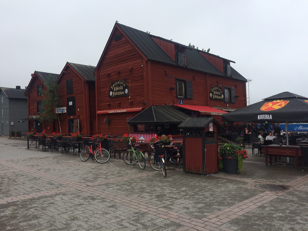
Now it was time to say fare well and “ha det bra” to Norway. We entered Sweden the next day and stopped in Göteborg for a walk around the lovely harbor.
When we came back to the bikes each of us had got a 60 € parking ticket… we had parked at bicycle stands… common. Well it was anyway time to go home. So we left Sweden with the Helsingborg – Helsingør ferry and crossed Denmark all the way to Rødby. From here we went on with the Rødby – Puttgarden ferry and returned to Germany. Our last stop was in Stelle, where my grandmother’s sister, Tante Else, is living. We had a nice evening with her together with Telse (her niece) and Peter and some Riesling wine 🙂
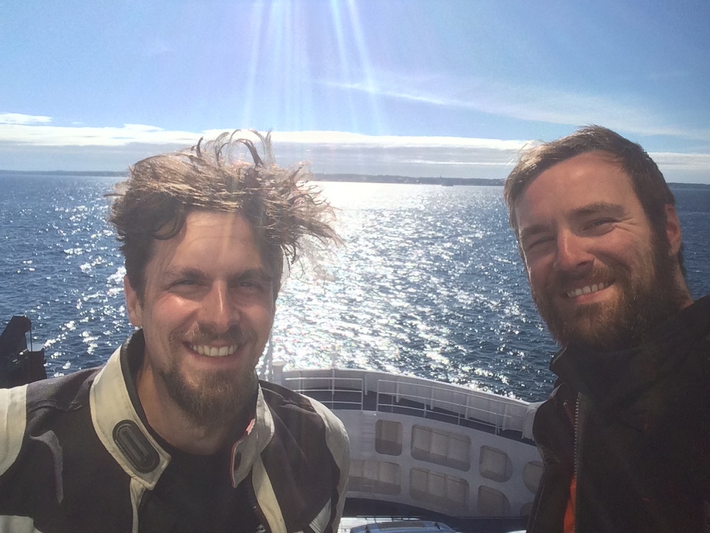
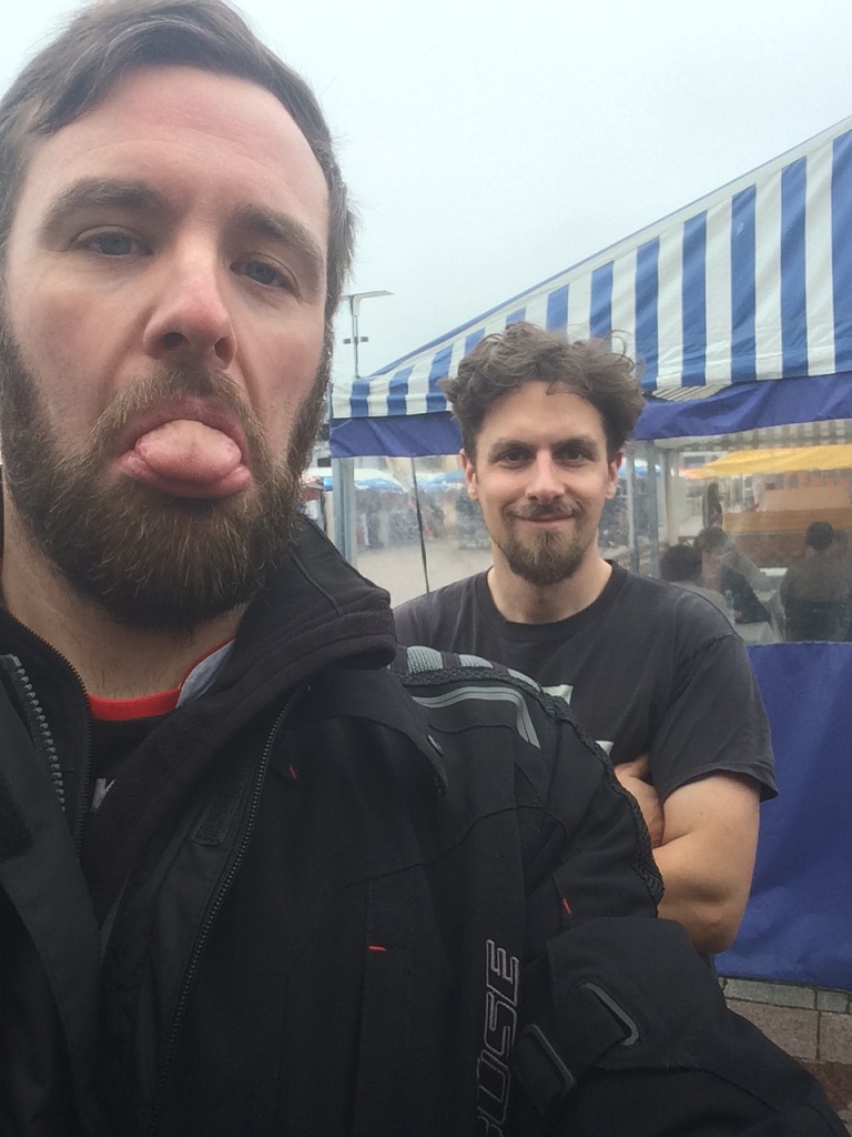
Than the last day of our trip was there. After almost three weeks, 6.500 km on the bikes and 9 ferry crossings we had our last brake a couple of kilometers south of Hamburg, before we would split up and say good bye. It was a great trip and a pleasure that Benny had joined me. Thanks for the awesome time 🙂
Norway is a beautiful country with a more than gorgeous countryside and wildlife. I told Benny a couple of times, if the temperature would be 5-10 degrees higher that place would be totally over populated 🙂 On the other hand I really want to come here again in wintertime and experience the second kind of world Norway has to offer. But this will be another story 😉
For now I want to thank everyone who was following the blog again, I hope you enjoyed it. Take care and see you soon on the road.
We woke up after a fairly noisy night due to the trucks that were passing right next to our tents. But as you all know the first rule of camping is do not forget the ear plugs. In fact since we were traveling north of the Arctic Circle for a while, in a time where the sun is not setting anymore I also brought an eye mask. There, I said it and I am not ashamed of it, never slept so good in my tent :p
The not setting sun and especially the midnight sun are something astonishing to experience. We first had it in Finland at the campsite after we passed Rovaniemi. We were sitting outside chatting and having a drink at 23:30 and it felt like early afternoon. You are somehow tired but also not willing to go to sleep because it looks like the middle of the day.
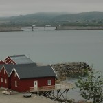
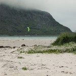
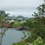
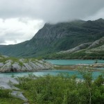
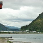
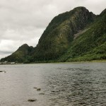
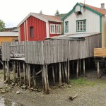
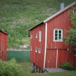
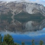
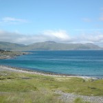
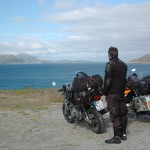
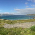
Our route for the day was Narvik to Moskenes, crossing a highlight of our trip: the Lofoten. The Lofoten are a group of islands connected by a road spanning almost 200 km. It is a beautiful rough landscape with huge mountains rising out of the ocean. On the other hand you have flat islands with white beaches, green grass and crystal-clear lakes. And in the middle of that all you can see small fisherman villages with the typical norwegian red houses. It’s better than a painting.
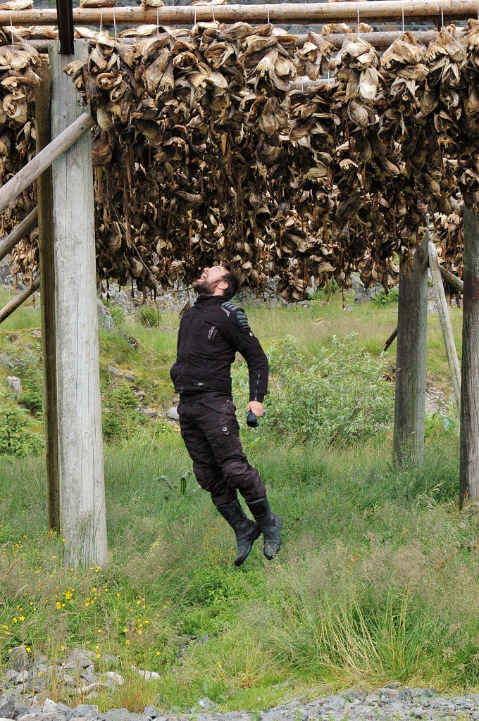
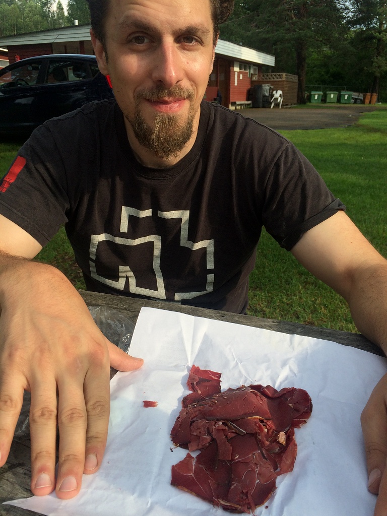
Fishing is still a big deal on the Lofoten (Lofotfisket) even so the amount of fish that can be caught has decreased drastically in the last 70 years from 147.000 t to 15.000 t. The main catch is codfish and around the half of it is used the produce Tørrfisk (stick fish). That means the fish is cleaned and then hung up to dry over a stick for 6 to 10 weeks. It’s the norwegian kind of biltong, but I have to say regarding the taste, biltong wins big times. Tørrfisk is really super dry, hard with a light taste of fish. We found some already harvested Tørrfisk hanging from the stick constructions along the road. There were only the heads of the fishes left, but it was too late Benny was already on the run 😉
The campsite in Moskenes was super crowded because it was just next to the ferry that brings you back to the mainland. The was a group of americans sitting in the center of the camp. They had a guitar and were “singing” songs like “country road” for the whole night. Rule number one!!! But we also met a very nice couple from Haiger (Germany, Hesse, Hibbdebach), they both were riding motorbikes with a sidecar. We had a really good talk about bikes, their mechanics, how to fix them and to prepare them and so on. I totally enjoyed it and in the end they offered us some of their SCHNAPS. As gentlemen that we are, we could not deny such a descent offer 🙂
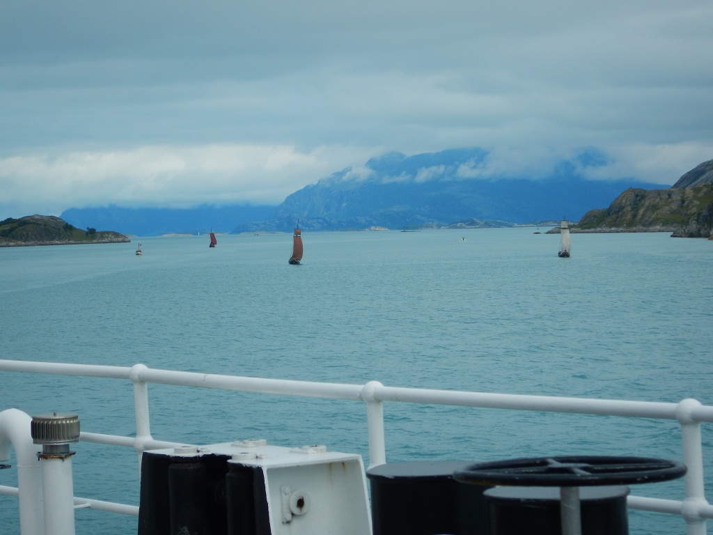
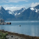
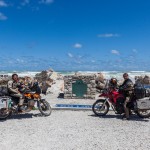
We took the ferry the next morning to Bodø. It’s a 4 h trip and as a farewell you get a nice view of the 1.000 m high Lofoten wall. Arriving in Bodø we were welcomed by a couple of Viking boats. Okay that were rebuilds for the tourists, but they were pretty anyways.
From Bodø we took the 17, an alternative to the main road (E06) along the coastline. This route contained two additionally ferry crossing. Wuhu three ferries in one day, new record 😉 For the last one we had to wait 1.5 h at the harbor to bring us to Kilboghamn. Time Benny spent fishing and I were sorting pictures. With this ferry we crossed the Arctic Circle again. From now on we will get darker nights the more south we get. We found a camping site right in Kilboghamn and had lunch at a nice little spot at the sea… how romantic ;p
Crossing the Arctic Circle
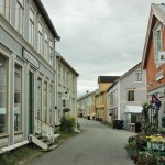
For the next morning we had a problem to solve, Benny was short on gasoline. I gave him the two liter from the spare can, but that would still barely last to the next city, Mo I Rana. But we were lucky and found an automatic gas station container, somewhere in the nowhere. Saved from an embarrassing disgrace we passed Mo I Rana and stopped 88 km later in Mosjøen. Here we visited the old town and walked along the Sjøgate, a famous walk with wooden houses in the style they used to be 150 ago.
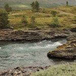
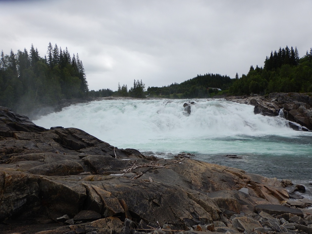
Some 30 km down the road we had our next stop at the Laksfoss. There are very strong and powerful rapids and you have the chance to see salmons ascending the river (Vefsna), we didn’t. But we met the side car couple again (unfortunately we forgot to tell names) 🙂
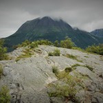
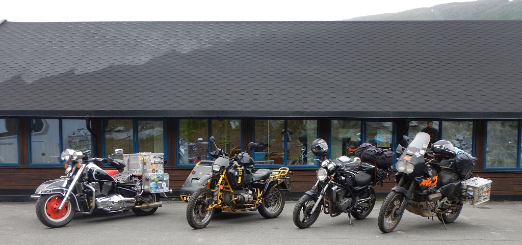
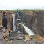
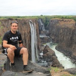
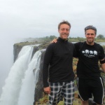
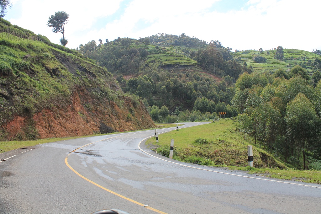
They advised us not to miss the Trollstigen, a very famous and most beautiful mountain pass. We hadn’t heard of that before, because it is south of the region we had planned to travel. We were good in time and decided to take this detour, after visiting Trondheim the next day. Our camp for the night was in Levanger.
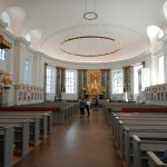
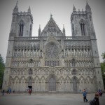
Liebfrauen Kirche
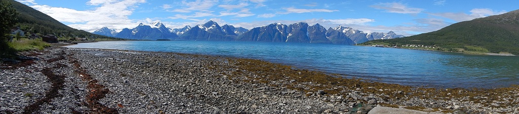
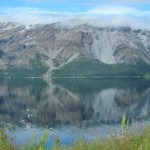
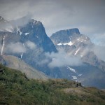
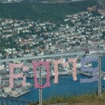
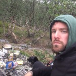
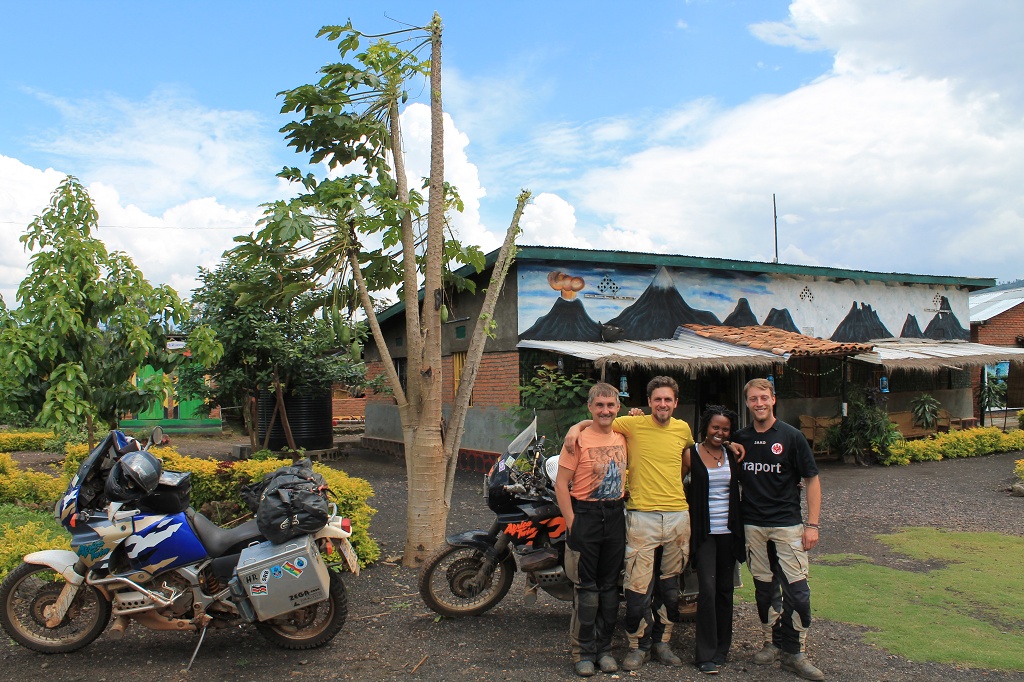
The way from Trondheim to the Trollstigen leads along the E136 through a magical mountain and forest scenery. No wonder they produced a good part of the Harry Potter and the Half-Blood Prince in this region. Unfortunately it was a very rainy day and I was not in the mood to stop for photos 😛 We settled down in a cabin 30 km in front of the Trollstigen. Here we met Marianne and Nicole, they came from the south and already did the Trollstigen that day. We had a very nice evening with Whisky and beer and chats about bikes and travelling. They also gave us some good tips for tracks we should take after passing the Trollstigen, our highlight for the next day.
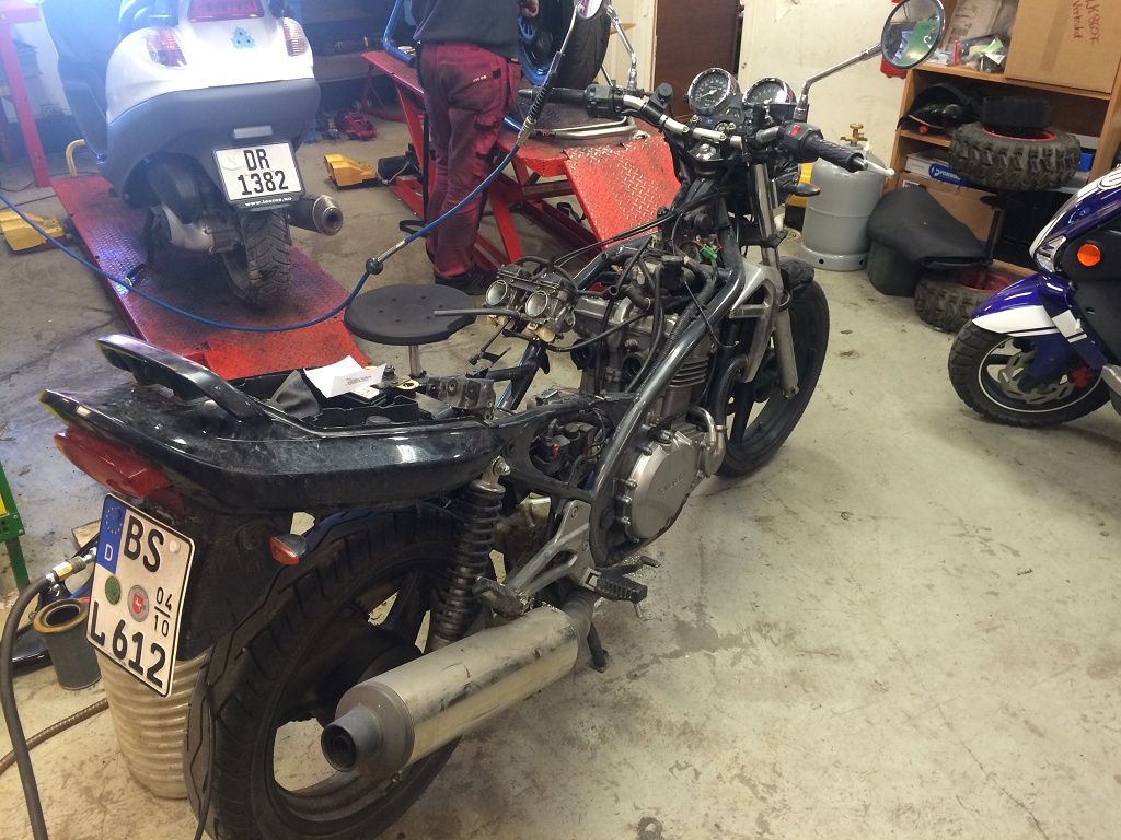
First things first: Monday morning we drove to the garage where Benny’s bike was waiting for repair. The guys were busy at the moment but would call Benny in the afternoon to give him feedback. Since we had only two weeks left to get home and didn’t know how long the repair would take or if it would be too expensive to do in Norway, we decided to split up. We worked out a plan that Benny could catch up with me in Nordkjosbotn or in Bodø if the bike got fixed in time. If not he would need the ADAC to handle the return of his bike and himself. At eight o’clock in the evening benny called me. He had been already on the road for 2 h and was now onboard of the first of two ferries on the way to Tromsø, where I was. But the good news didn’t last long. Gasoline was leaking again and the bike didn’t start when he wanted to get off the ferry. Same issue as before. Luckily he got help from the captain, who organized a hotel for the night and a transport to Tromsø for the next day.
I met Benny at the garage in Tromsø at 12 o’clock just as his bike came of the truck.
Long story short the mechanic there was totally willing to help us, super friendly and the best thing he knew what he was doing and fixed the bike!!!
In the end it was a blocked needle valve of the floating switch of the right carburetor. The guys form the garage in Alta just drained the gasoline and changed the oil, but didn’t look for the cause of the problem, but they charge almost the same.
Thanks for nothing…
Around 16:30 we were good to go and after a test run of 20 km without leaving Tromsø, we were back on the road again heading towards the Lofoten.
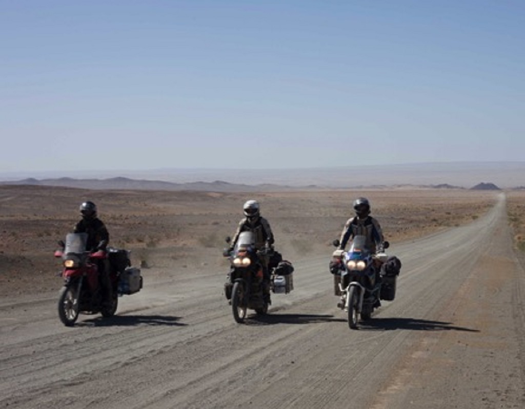
So now that we are safe and sound, let’s get back to business. Leaving Alta with sun shine for the whole day, I took the E6 to Olderladen. From there you can get to Tromsø using two ferries. With the first you cross the Lyngenfjorden, from Olderladen to Lyngseidet. After a short 22 km ride you cross the Ullsfjorden from Svensby to Breivikeidet. From here Tromsø is only 55 km away.
The ride was really nice thanks to the perfect weather and ferries are always a good fun. I stopped frequently to take pictures of the amazing and just beautiful scenery (seriously I started to annoy myself… omg he is stopping again). But really when the first mountains of the Lyngen Alps appear, it’s amazing. It looks exactly as the travel guide says, like as someone had thrown the Alps into the North Sea. They span about 90 km and have their highest summit in the 1833 m tall Jiekkevarre.
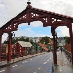
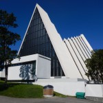
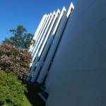
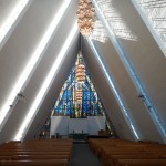
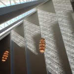
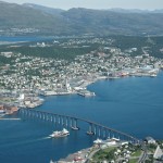
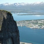
I stayed the night in Tromsø Camping and did some sightseeing in the morning while I waited for Benny to be delivered. The two major landmarks of Tromsø, the Tromsø Bridge and the Arctic Cathedral, are just right next to each other. The bridge connects the island of Tromsøya, on which most of Tromsø including the city center is located, with the mainland. There is a cable car that brings you up the Storsteinen (422 m) from where you have a great view over Tromsø.
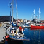
I spent some time walking through the harbour area watching all the sailors and boats. That is something for a future trip 😉
Benny arrived around noonish and after his bike was fixed we made a good run down to Narvik. We wanted to get to the campsite there, so if the bike would leak again we would be in a city. But the campsite was closed, because they were building a bridge over the fjord right there. That sucked, but in generell it’s a good thing considering the ride around the fjord that takes like forever and we had to do twice. Around ten o’clock we were at the next campsite, they didn’t offer spots for tents… nnnkay. So wild camping it was. The bike did well over night and we could continue our journey, next to come were the Lofoten!
We spent the night at a nice camping site just next to the river in Rovaniemi.
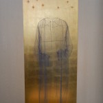
Pollice Alto
First on the list for today was the Arktikum, where the Arctic Center and the Provincial Museum of Lapland are situated. Both examine culture, history and modern life in the artic. The temporary exhibition was all about the artic cuisine.
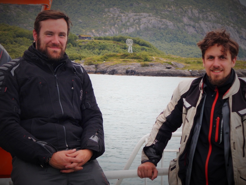
Our next stop was the Santa Village where you can also find the marker of the Arctic Circle. The whole complex is a huge touristic attraction with tons of souvenirs and stuff where you can spent your money on if you wish. You can also get Santa to write a letter that will be delivered at Christmas for only 7.90 €. We kept calm and got some postcards. Of cause we could not leave without a picture standing on the Arctic Circle. Disappointingly the mark was situated in a pedestrian zone. But we found an entrance big enough for the bikes with no prohibition sign 😉
We hit the road again and after a good and dry ride for 380 km we arrived in Giellajohka. Our camp site offered fishing licences for the adjacent river. So we tried our luck and after a couple of hours we had pasta for dinner, at least with tuna 😉
Midnight sun
The next morning we already left Finland. We spend clearly not enough time in Finland to get a real impression of the country besides what you can see from the main roads. But when time is limited you need to cut edges and the focus for this trip is Norway. I liked it here and will visit Finland again for sure. Winter times with a finish sauna sounds like a perfect match!
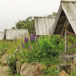
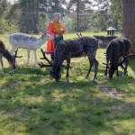
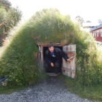
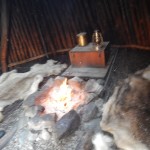
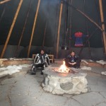
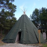
We entered Norway at the border crossing next to Karasjok (NOR), it’s the capital of the Sámi people (also known as Lapps, but this name is not well-liked). The Sámi are the only indigenous people in Scandinavia. They are an ethnic minority with a population of 90.000 – 140.000. The region they inhabit is called Sápmi and it spans over Norway, Sweden, Finland and Russia. In Karasjok or Kárášjohka how it’s called in Sami we had a look the at the Sámi parliament (Sámediggi) and visited the Sápmi Park. It’s an open-air museum where you can experience some of their traditional way of life, whereas most of the Sámi have switched to a “modern life”. In the park you’ll find e.g. typical campsites for summer and winter. You can see different types of huts (even some movable on skids) and tents that each have a special purpose.
Sami Parliament
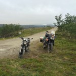
We went on north again without rain so far and even a bit of sunshine from time to time. The ride along the coastline was just beautiful, even if it got a bit cold and windy. Every now and then we had to stop to take a picture of the splendid view.
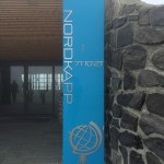
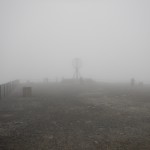
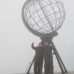
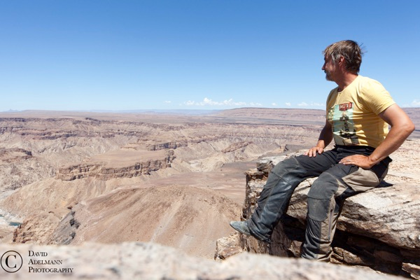
When we passed the 6.875 m long and up to 212 m below sea level reaching Nordkapptunelen we knew it’s not far anymore. We had some more tunnel crossings that were all freaking cold and not really well illuminated. Shortly after we drove past Honningsvåg we had to put the rain stopper on, because it got really foggy. With a vision of 10 – 30 m for the last 10 km we finally reached the North Cape. I don’t know if it would’ve been possible to go with the bikes around the touristic North Cape Center to park the bikes in front of the globe monument. But since we couldn’t see anything and the cliff leads 300 m down into the Sea of Ice we walked there like normal people 😉
From the North Cape it’s about 2.100 km to the North Pole, but it’s not the most northern point of Europe or the european mainland (the cape is on an island). That would be Knivskjellbodden and the Cape Nordkinn respectively. A lot of royalty has been to the North Cape e.g. from France, Sweden, Germany and even from Siam (King Chulalongkorn), so no wonder we needed to stop by :p
We traveled back south again to a camping site in Repvåg. Here we watched the semifinal of the European Championship Germany vs. France, but let’s not talk about that.
On the camp site we met a couple of guys who did a benefit run from the Timmendorfer Strand in Germany all the way to the cape (www.spendenlauf-nordkap.de). Well done guys!
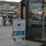
Our destination for the next day was Alta. We took a detour from Skaidi to the so called most northern city of the world, Hammerfest (ja, that’s not true ;)). After crossing the impressive 740 m spanning Kvalsund Bridge we would’ve been able to see a sharp rock formation called Stallo, which was used as a pre-Christian sacrificial altar by the Sámi. Unfortunately we somehow missed it on the way in and back. Maybe it’s on the road around the tunnel, which we could not take. In Hammerfest we visited the Isbjørnklubben and became members of The Royal and Ancient Polar Bear Society. Yeah another one for the CV :p. It had started raining again when we reached the monument of the Struve Geodetic Arc. This arc is a chain of survey triangulations that spans from Hammerfest almost 3.000 km through ten countries to the Black Sea. It was used for the first accurate measurement of a meridian.
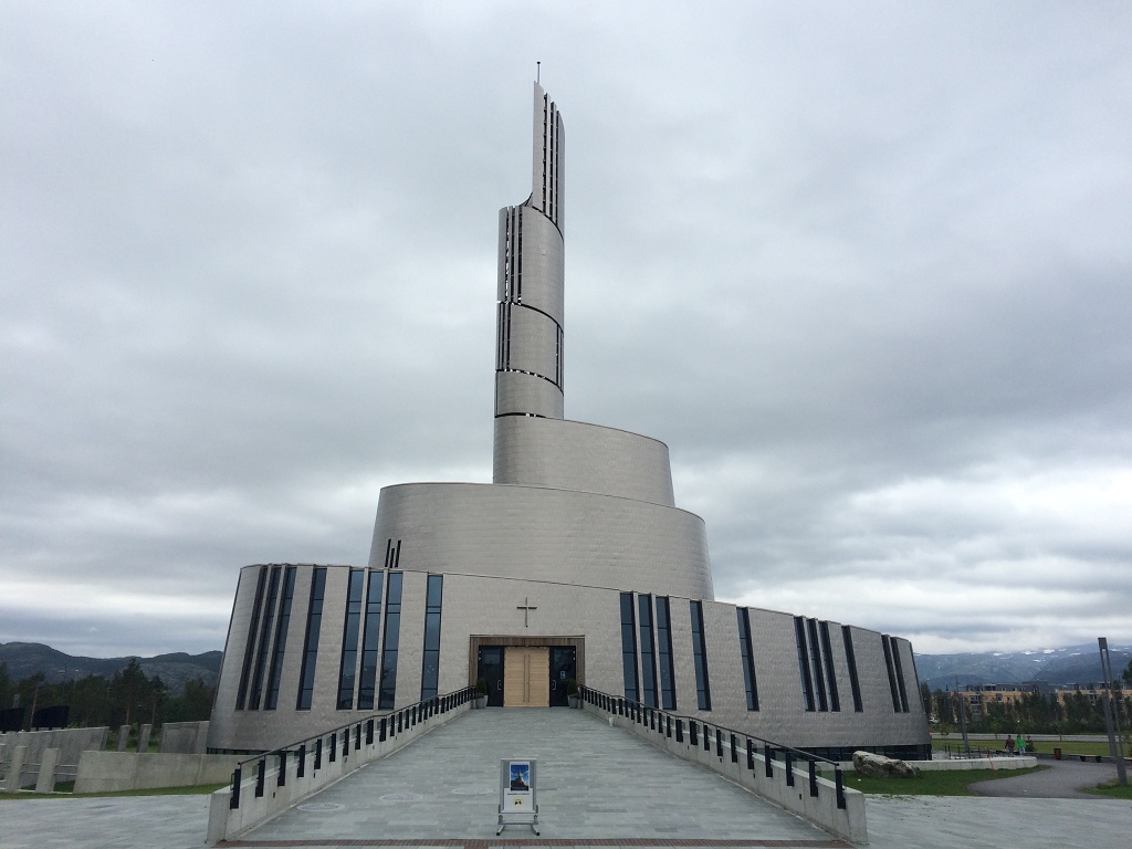
Church in Alta
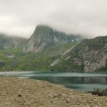
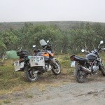
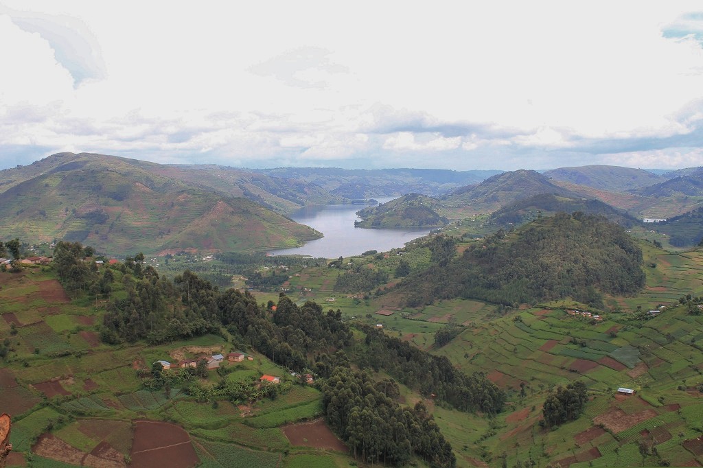
A couple of kilometers south from Alta you can find the Sautso Alta Canyon. With a length of 15 km and depth up to 500 m the largest canyon of Northern Europe (really). From a parking area it’s only reachable by foot as a 2 h hike. We wanted to put up the tents somewhere near the parking place and do the hike in the morning. The last kilometers were up the mountain on a not so good looking gravel road. I was a bit worried how Benny would handle it since it was his first not tarmac ride, but he did more than well. Not a problem at all! After a little try and error game we found a spot for the night with less than one quadrillion mosquitos per person. We had a soup for dinner and went to sleep as the first rain drops started to fall.
Of course it didn’t stop raining the whole night or the next day. No chance we could do the 4 hours hike without getting soaking wet… so we skipped the canyon, gathered our stuff and went back to Alta for breakfast. It was good and warm and dry. I bought a Statoil cup that gives you free coffee refills at every Statoil gas station. I need 15 coffees to make a benefit, 14 to go ;).
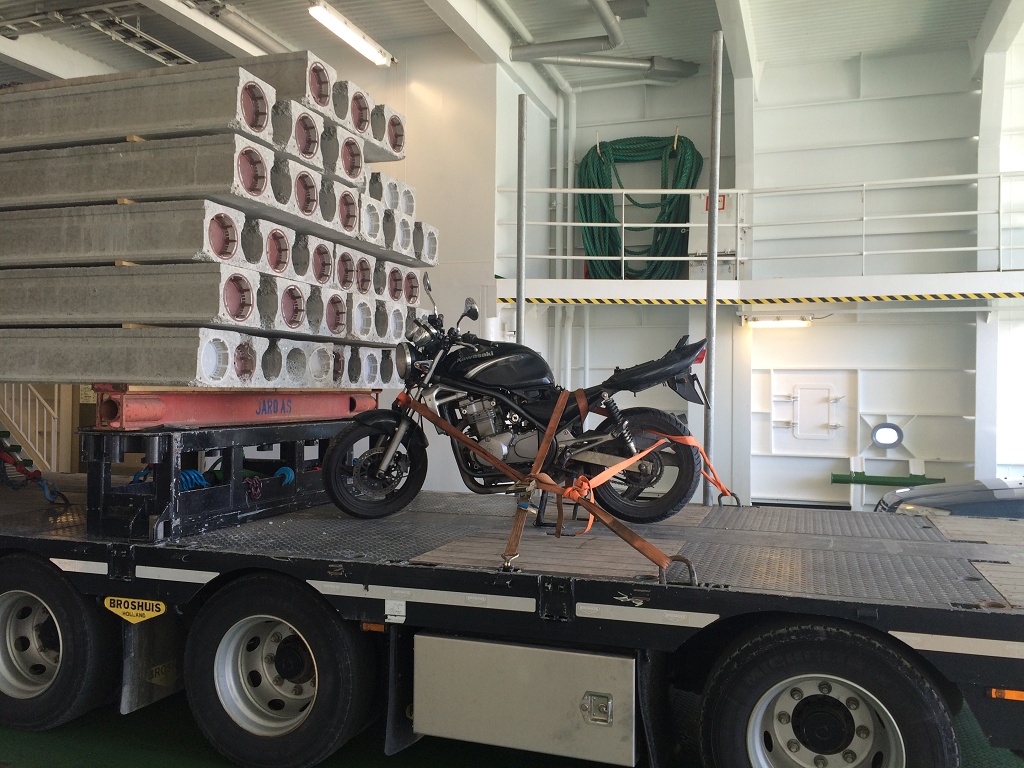
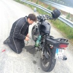
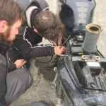
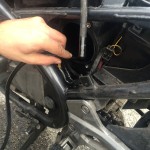
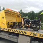
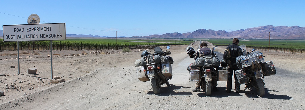
For the next days we wanted to go roughly in the direction of Tromso. There is a nice alternative to the main route, where you do two ferry crossings. But we didn’t get that far. On a photo stop Benny got on the grass edge and just after he stopped the bike slipped to the side. Well no big deal I thought. But some minutes after we had lifted the bike up again there was gasoline leaking out of the air filter… We opened it up, completely filled as well as the carburetors and there was also gasoline in the engine oil. So the complete system was filled with gasoline. Minimum we need to do is an oil change, get rid of the gasoline, have a look at the fuel tap and the float switch of the carburetor. Nothing you want to do on a side road in Norway, time to call the ADAC. The guy arrived quite quick and brought Benny and his bike back to Alta. Unfortunately were all garages already closed, it’s 13:30 on a Saturday, and won’t open before Monday. Where is your croatian 24/7 garage when you need it…
We will stay now in Alta till Monday and talk with the guys from the garage. Then we will see how things are working out, so keep your fingers crossed.
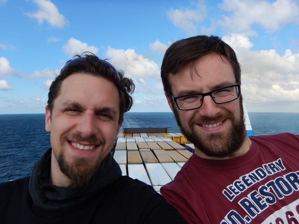
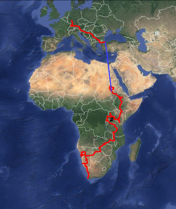
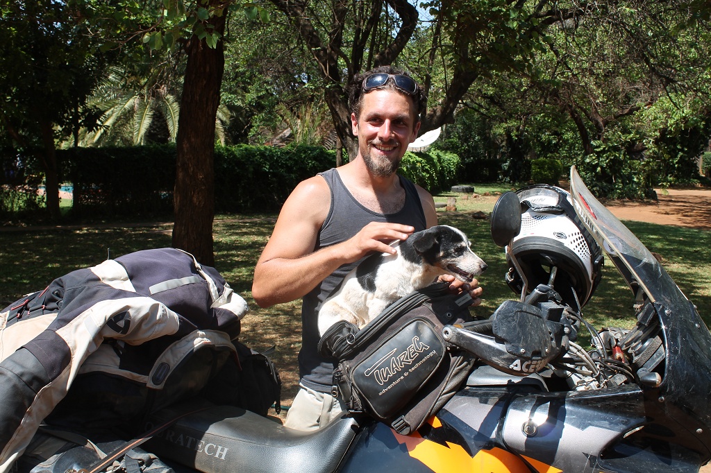
it’s been a while, almost two years since Topher and I started our transafrican tour, oh man how time is running! A lot has happened for the both of us, but another longtime motorbike trip was not part of that, unfortunatly. That needs to change!
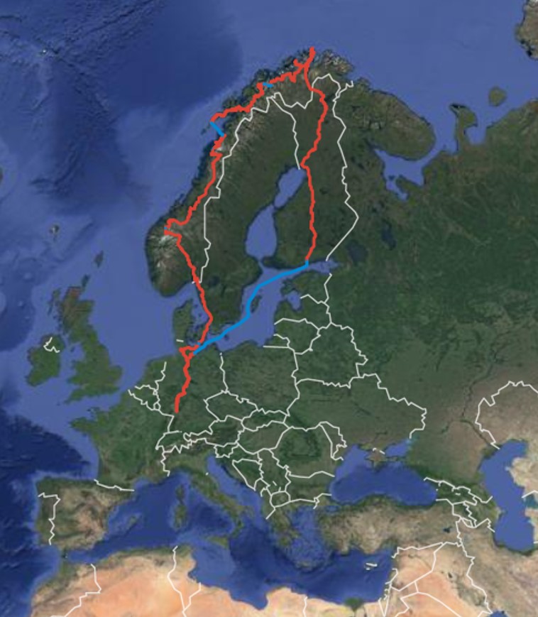
Last year I thought since we’ve been to the Cape of Good Hope and the Cape Agulhas (the most southern part of Africa) it would be a nice thing to take the Twin again for a journey to the North Cape in Norway, Europe’s most northern point (that’s not really true but very close :p).
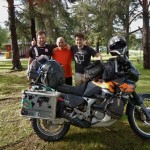
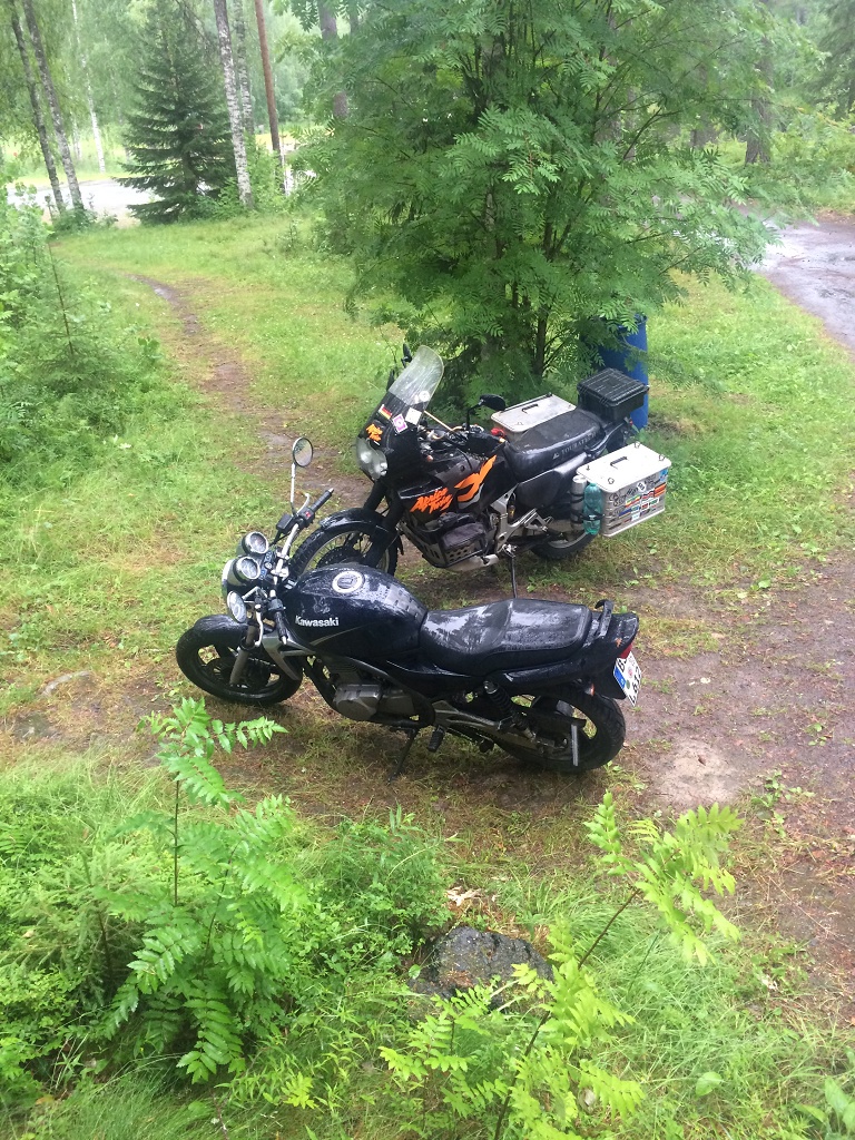
This time Topher and also David didn’t find the time, what a pity. I scheduled three weeks for that trip, one week to get to the cape crossing Finland and two weeks to travel Norway on the way back. When I told our good friend Benny about it (you may remember him as our first and very generous host on the transafrican trip), he was very keen to join with his Kawasaki ER-5 and we teamed up :).
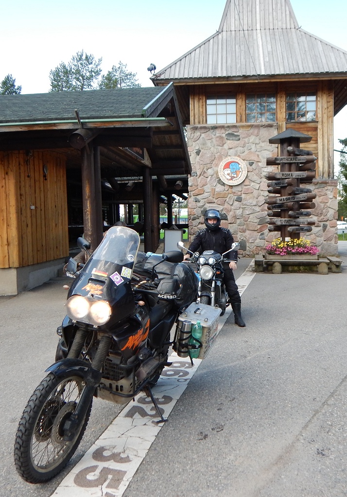
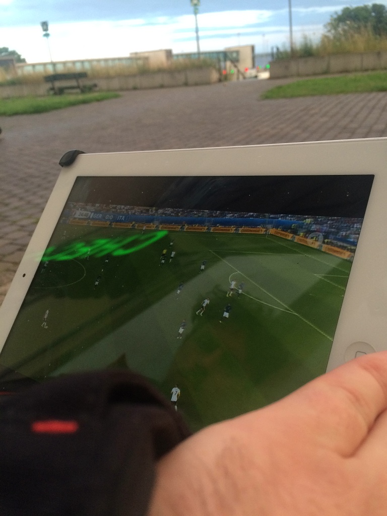
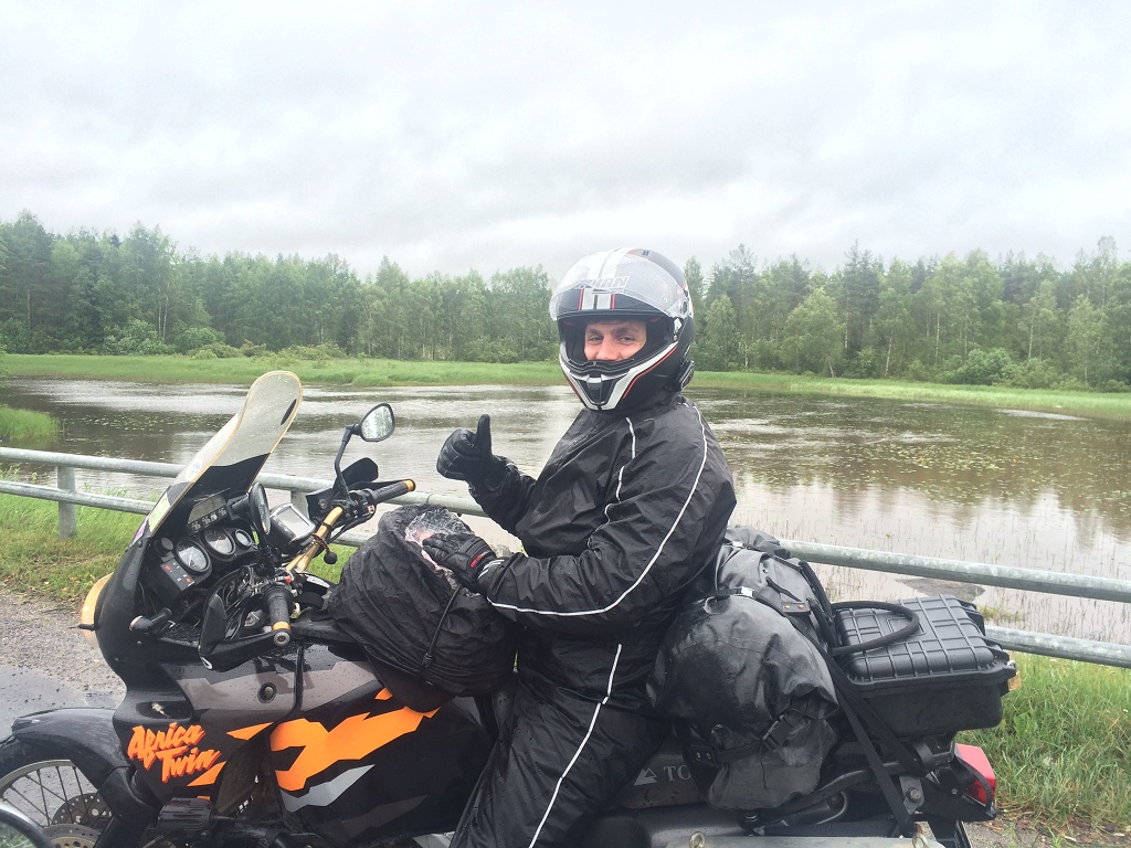
After a bit of planning, preparation and some repairs and upgrades of the bikes in the last six month, we finally started on the 02.07.16. Departing from Heidelberg, with a farewell in Frankfurt I met Benny in Hamburg from where we drove to Travemünde to take a ferry to Helsinki (Finland). Check-in was 21:00. Same time as the kick off of quarter finals of the European Championship, Germany vs Italy. We arrived early and got the check-in done in no time. After a short but intense run to the restaurant seeking a tv, we found out that the only one was broken… oh man, its eurochip… what the… how can this… what is wrong with those people…
Luckly Bennys mobile contract just got upgraded so we were able to stream the game and also found new friends 🙂
The ferry took of at 03:00 in morning, but we were already sleeping on our camping mattresses. We didn’t book a cabin, this is adventure 😛
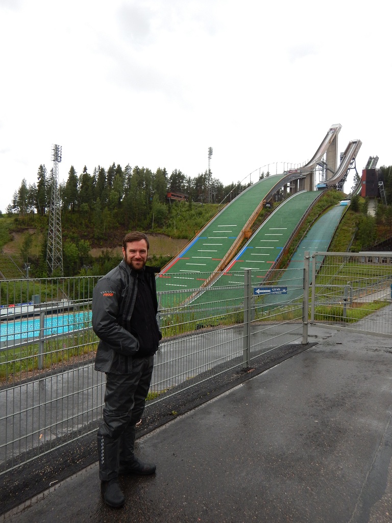
Two nights and 30 hours later we arrived in Helsinki and were welcomed by the finnish summer. Heavy rain for the whole day. Our first destination was Lahti, where we wanted to visit the Hiihto museum, a skiing museum. It was closed, but we had a good look at ski jumpes and a coffee.
Back in the rain we were heading north and stopped for a burger in Jyväskylä. Our destination for the day was the camp site Hännilänsalmi next to Ilmolahti. After showering for the last 360 km we decided to take a room and skip the first night in the tents ;).
We had a good rest and started with just a gentle rain. Our first stop was Oulu. Here we parked the bikes in the middle of the town and walked to the daily market. For lunch we had awesome salmon with some kind of tiny fried fish, garlic potatoes and grilled veggies. There is also a small market hall that is somehow similar to the world famous Kleinmarkthalle in Frankfurt, only kleiner ;). We got our first reindeer, in slices, cold smoked, nice.
On the road again we had sunshine for the first time. Oh what a joy riding in Finland can be, without the rain stopper. We had a really good run today and reached Rovaniemi after 477 km. Here is the official residence of Santa Clause and we will cross the Arctic Circle, but this has to wait till tomorrow.
P.S.: After setting up the tents we finished the day with a glass of whisky, mosquitos and pouring rain for hours 🙂
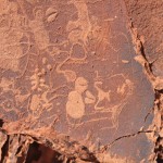
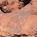
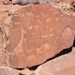
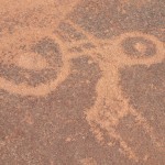
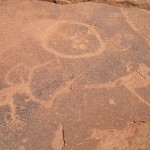
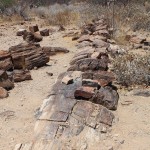
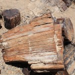
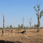
We left the Brandberg area on the 1st of December, going a bit north to see the rock engravings at the Twyfelfotein. Only gravel roads take you there. They are in excellent condition so it was really good fun to ride there. Twyfelfotein is Afrikaans for doubtful spring and not twelve springs as one might thought. The german word for “Twyfel” is “Zweifel” which sounds quite alike. This spring was called doubtful, because it is not constantly carrying enough water to survive. Probably this place would have been abandoned and forgotten long ago, if it hadn’t been for the rock engravings. Until now over 2500 individual engravings have been found, most of them are older than 6000 years.
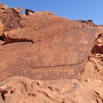
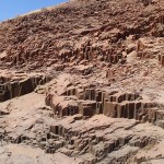
Nearby the engravings there are petrified trees, a burnt mountain and organ pipe like rock formations to be seen.
organ pipes
Burnt Mountain
After a night at the Aba-Huab campingsite we took the route over Outjo and Okahandja to get back to Windhoek. On the way it was now Topher’s fuel pump that stopped working probably. In Windhoek we replaced all tubes and tried to get the same exchange pump that we mounted on my bike, but unfortunately they didn’t have another one. So we tried a different one from a different shop. But that low pressure pump wasn’t so low at all and destroyed the sealing of the carburetor… Okay now that things got serious we went to a Yamaha dealer nearby. The guy was super friendly and very helpful. He managed to fix the carburetor, cleaned it and also took a look at the first pump. It seemed to be fine. We assembled everything again and gave it a try, but after 20 km the engine started to lose power again. The only thing to prevent that was not to drive faster than 80 km/h. So that should be our schedule speed for the remaining route. We realized that time was brutally running down and that we had to skip something to reach Cape Town in time. Sadly we decided to leave Sossusvlei out and to go directly to Lüderitz.
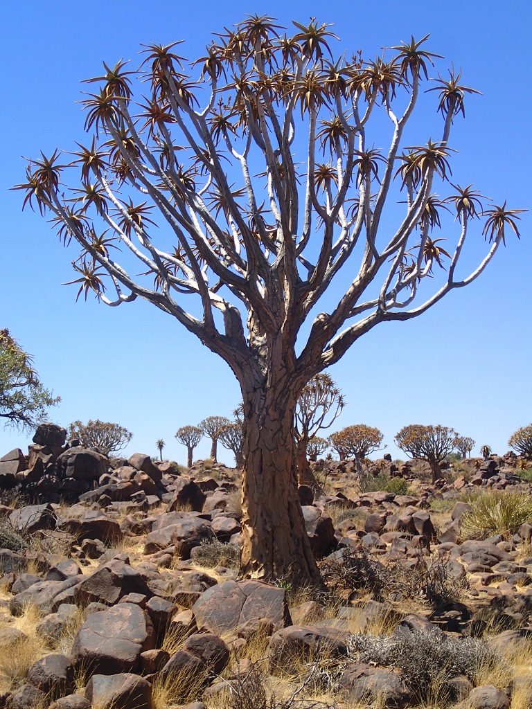
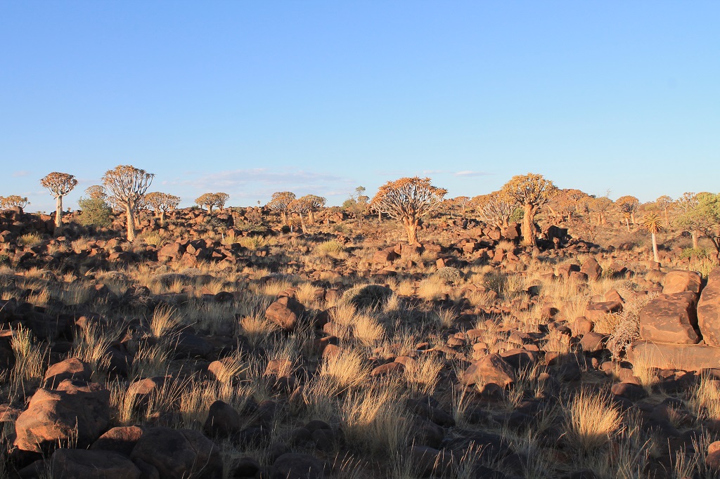
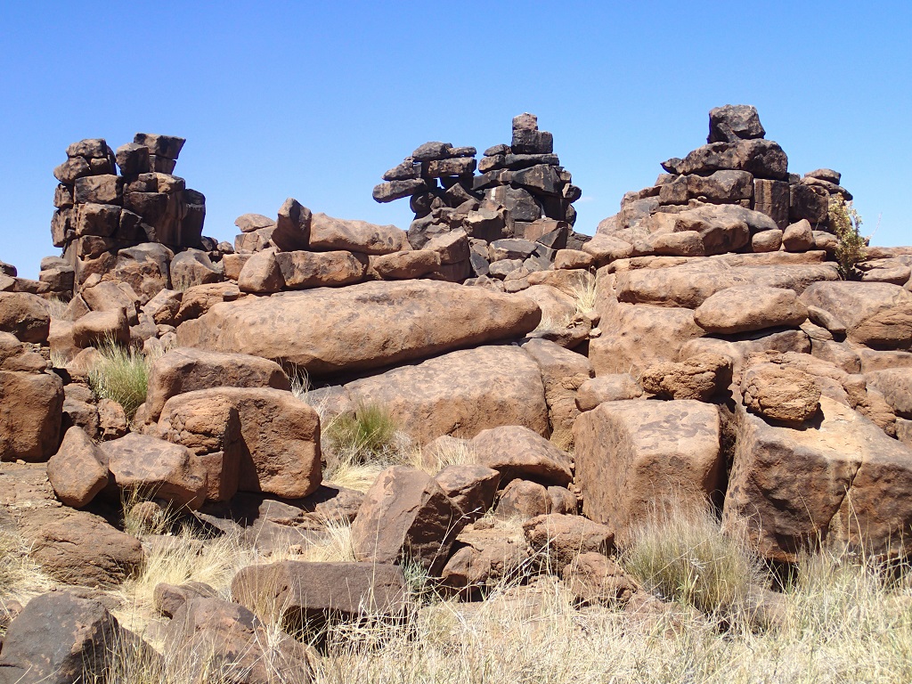
Passing Rehoboth and Mariental we reached Keetmanshoop after 500 km and 3,5 curves and stayed for the night in the Quiver Tree Camp. There you can take a look at Namibia’s biggest quiver tree forest and a place with stacked rocks called giants playground.
Quivertree
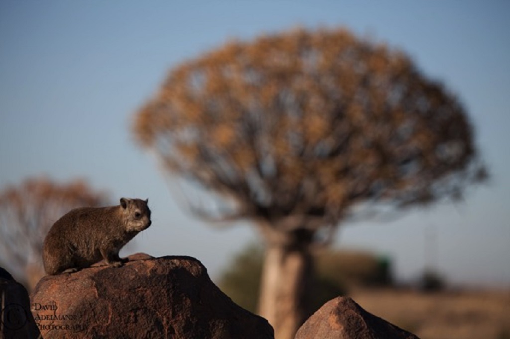
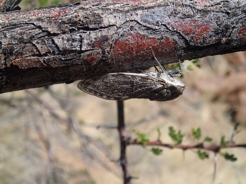
Dassie (in german: Klippschliefer) cute little things, but they give you a mean look all the timeGiants playgroundCicada as bis as a thump
Topher decided to dismiss his fuel pump and connected the tank directly to the carburetor. It seemed like using only gravity flow to feed the carburettor was more efficient than the half working pump. To keep the gravity flow pressure up high Topher was fuelling up at least every 100 km. The bike still wasn’t working fine, but we could do now 90-100 km/h without break down and reached the seaside town Lüderitz.
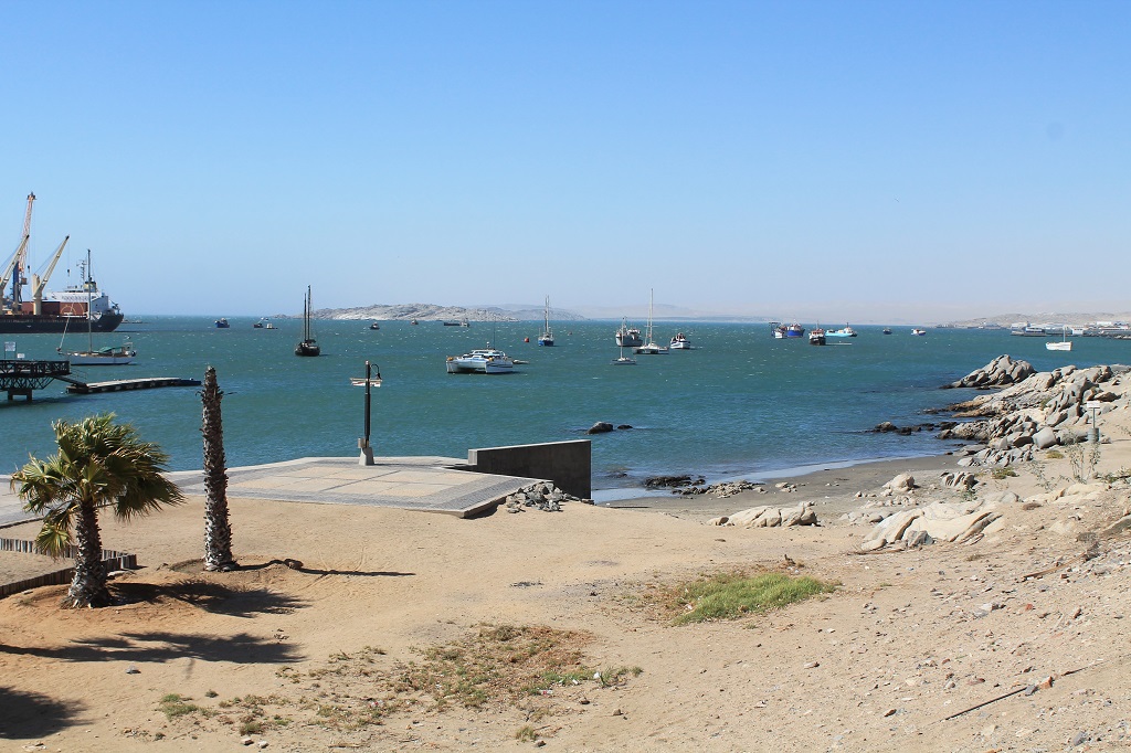
Lüderitz
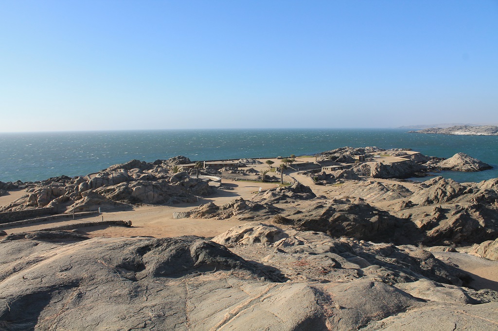
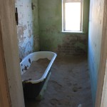
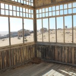
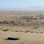
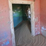
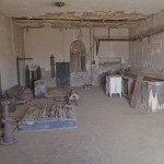
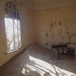
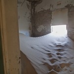
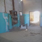
While we were staying in Lüderitz we did a day trip to the Sperrgebiet national park and visited the ghost town of Kolmanskop. Once planed as the headquarter of the Consolidated Diamond Mines, it was deserted in the 1950’s due to the collapse of diamond sales after world war one and the discovery of richer diamond fields near to Oranjemund. The ghost town is now partly covered by sand and a famous tourist attraction.
Hospital
Ice block manufactor
our advent wreath
Diaz Cross
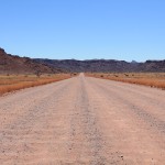
Now was only one spot left before we had to leave Namibia, the fish river canyon. From Lüderitz we took the C13 south, which leads all the way down to the Orange River, the natural NAM-ZA border. Following the river to the east was probably one of the most beautiful rides of the whole trip. The gravel roads are just perfect to drive on (probably our gravel riding has improved as well;) ) and the eternal rock desert landscape was so colorful and transforming as you can’t imagine.
We turned left on the C37 and went north up to the camping site Ai-Ais. From here we had planned to go to the fish river canyon the next day, but only David made it. All three of us were struggling with a flu like affliction since a week or so. In the last couple of days it got worse for Topher and me, while David recovered. This day 100% of Dribbdebach-Touring stayed in bed, partly knocked out, and David did the 50 km trip by himself. Thus also the fish river canyon remains a destination for our next trip to Namibia.
The following day we were feeling better but still not really in a good shape. Unfortunately time was running and so were we, if 90 km/h can be considered so 😉 We went south until we were back on the C13. After a while the gravel road turned to tarmac and we stopped knowing that this had been the last gravel road of our trip…
the end of gravel roads
Now it would only be getting the distance done without falling asleep and so it was. The border crossing was a drive by and after an overnight stay in Vanrhynsdorp we reached Cape Town.
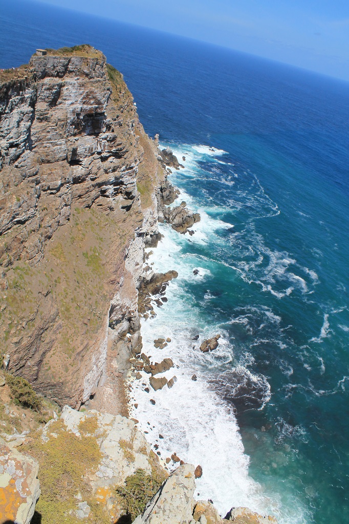
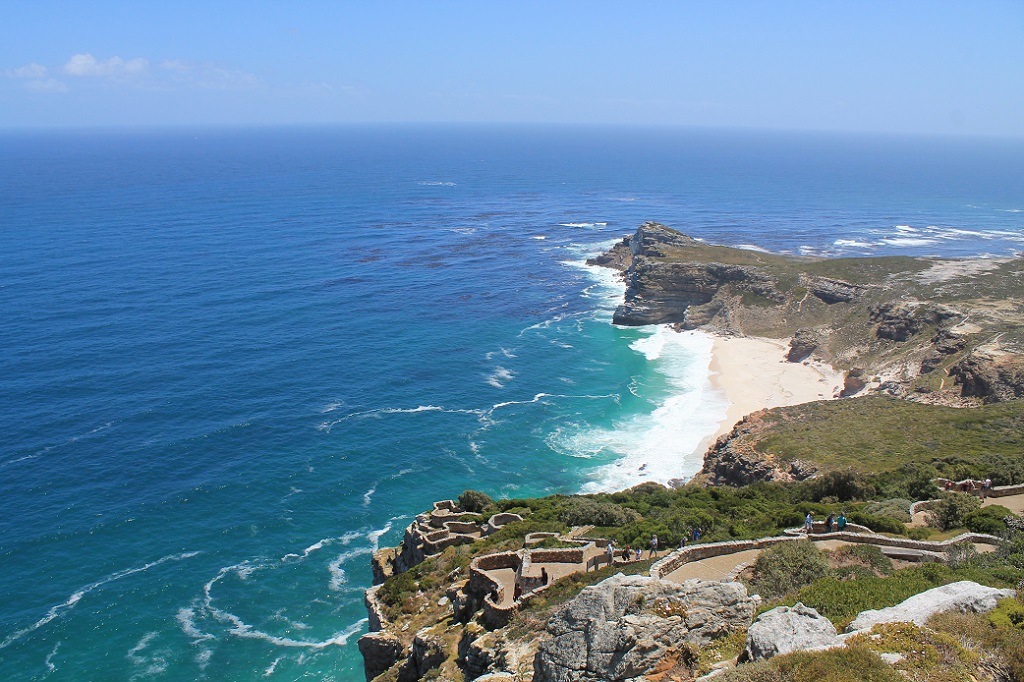
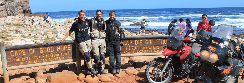
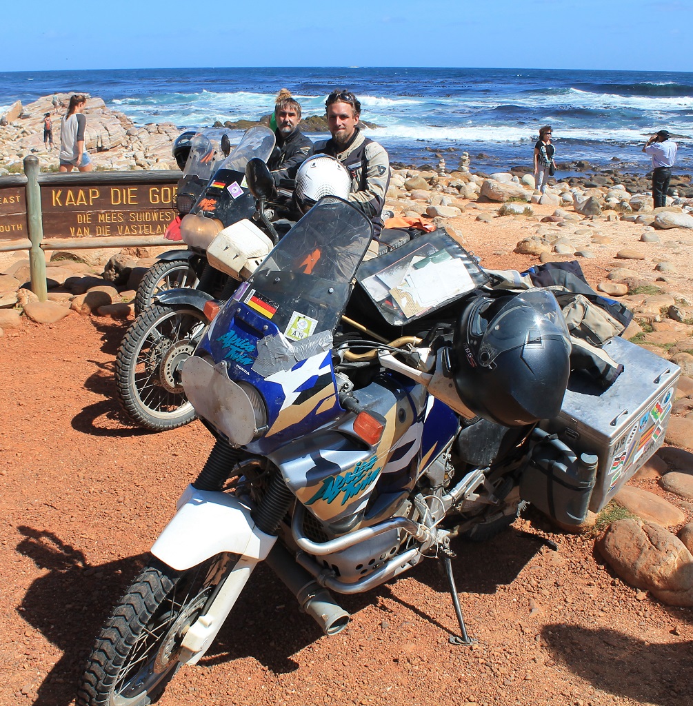
We took a day to settle down at the Ashanti lodge and did a city tour in a red bus. In the evening we went to the famous Longstreet for dinner and to get a taste of Cape Town’s nightlife. The next day, exactly four month after we set off, we drove to the Cape of Good Hope our final destination…
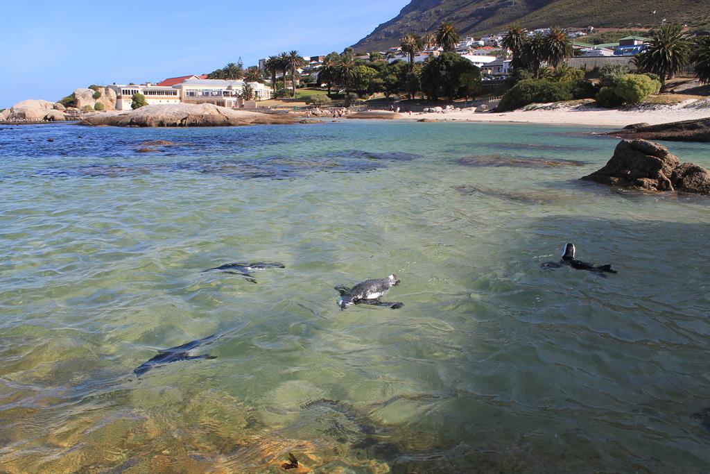
Clever penguins. The cap is much nicer than the south pole.
Time seems to fly by when you’re having a good time and the last 4 month living on the road just passed in a rush. But if we recall any day of the trip it was so full of experiences to earn, friends to meet, fears to overcome, freedom to find, adventures to master, fun to have and tears to cry that every day could count for a whole week.
Topher took a flight the next day to meet his parents and girlfriend in Windhoek. They were traveling Namibia for three weeks and took a flight back to Germany on the 01.01.2015.
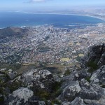
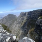
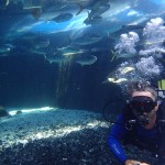
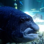
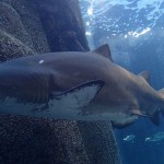
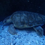
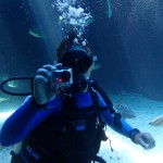
David and I spent another week in Cape Town, where we organized the transport of our bikes, did a two days trip to the Cape Agulhas (the most southern point of Africa), climbed the Table Mountain and did some diving in the 2 Oceans Aquarium in Cape Town and in the Atlantic near to Simons Town.
With the end of this trip the biggest adventure of our lives (so far) is completed and it left us with mixed feelings. As much as we were happy that we really made it and were looking forward to see our families and friends again, we were saddened about the end of this phase of life. But be sure there are more trips to come.
Finally we want to thank you very much for following our blog and for thinking of us from home or somewhere else of the world. This trip wouldn’t have been possible without the help and support of other people. Therefor we are very grateful and want to especially thank everyone who took a part in our cause.
We are really clad to have teamed up with David who was a great travel companion, a big help and became a good friend, thanks!
Take care and we hope to see you all again or to meet you for the first time in real life
The border crossing into Zambia coming from Malawi was again a piece of cake, easy and quick that’s how we like it 😉
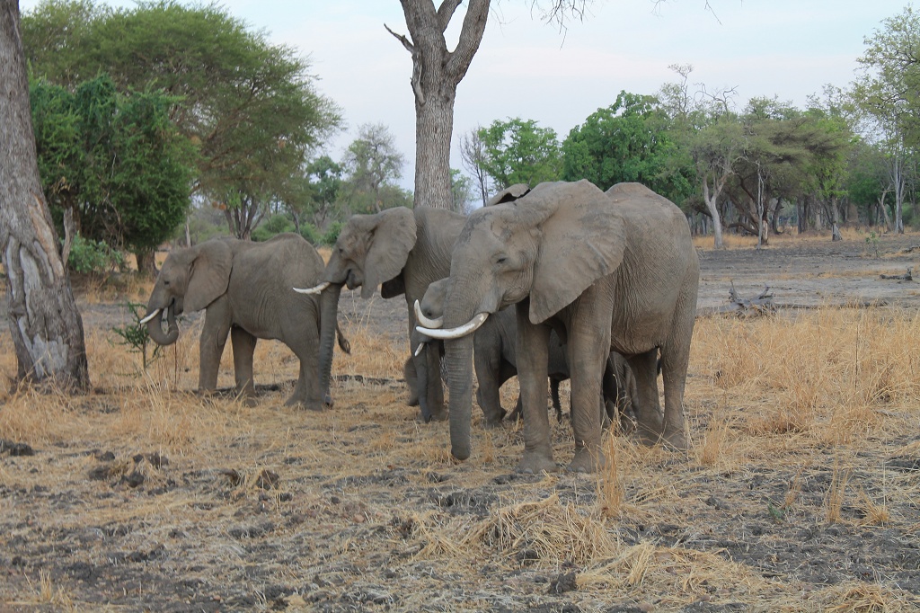
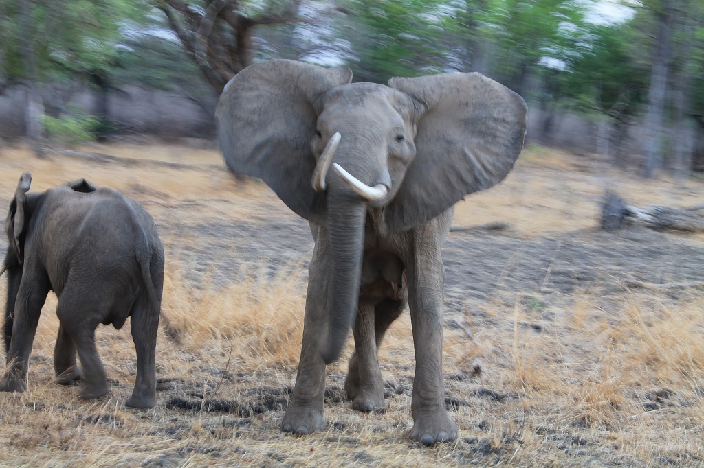
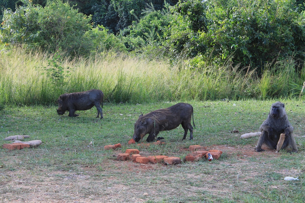
From Chipata we went a bit north to visit the South Luangwa National park. There we spent two nights in the croc valley camp, unfortunately a place that we can not recommend. It’s run down quite a bit, but that wasn’t the problem. They have volunteers, some european teenagers, working at the bar… that’s gone help someone in Africa for sure, but it’s good for their c.v. I guess… Anyway most of the time they were playing pool against the stuff. So you couldn’t play pool or order a beer at the bar… but the most fxxxed up thing was the treatment of the vervet monkeys. They don’t have garbage cans with a lid but a sign that says: “please don’t feed the monkeys”. But that’s exactly what you’re doing if you put anything in that garbage can. So they have plenty of monkeys all over the place that want to steal your food if you don’t watch out. Instead of getting some monkey save garbage cans those lovely pals think shooting stones at them with sling shoots would teach them not to raid the garbage… really
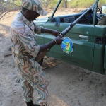
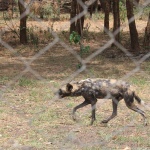
We did two game drives at the south Luangwa NP. First a game walk, where you walk with a guide and an armed security guy through the park. It was really cool, they show you the tracks and droppings of different animals and tell you something about the plants and insects you see on the way. The droppings were so interesting that I bought a catalog for that by now, it’s called the scatolog and will be accessible in my restroom shortly. We also saw a lot of animals and even had a glimpse at a leopard 🙂 The second game drive was a night drive, but it didn’t really pay off. It starts like a normal game drive and when it gets dark they come up with a big searchlight and sweep it from one side to the other. It feels like watching a tennis match. Unfortunately we didn’t see much, especially not the rare wild dogs… but we were a bit dizzy when we left the car 😉
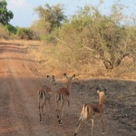
public impala toilet
We didn’t take the main road back but went for a dirt road that went next to the Luangwa River and through the park. That was the right choice, we were back in the middle of nature and the road was good to drive. Ok there were some sandy parts and we had to cross a dried out river bed or two. Ok we were lucky that it didn’t rain… like it looked like the day before we left, but everything else was perfect 😛
For the coming night we pitched our tents in the Luangwa Bridge Camp, a nice place with good food.
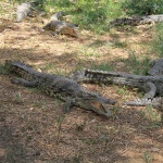
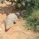
Passing Lusaka the capital of Zambia we went for the Lower Zambezi National park the next day. In Lusaka we visited a reptile park that also had a swimming pool. It was a rather small pool, where 10 children would fit in and 30 did 🙂 Anyway a good combination kids, crocodiles and snakes… what could possibly go wrong. Reptiles are gorgeous animals and it was a nice experience to see some of the most deadly creatures of Africa. They also sell different crocodile articles like leatherwear, jewelry and meat. That was the first time on our journey that we had the chance to taste an animal not common in Europe. Dinner that day was one kilogram crocodile tail for barbeque. The meat had a light but good taste not fishy at all, although the composition of it felt more like fish than mammal.
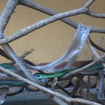
Boomslang male
Boomslang female
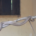
Black Mamba
Puff Adder
Wild Dog
exactly that was our position to take a shower in iringa for 4 days
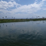
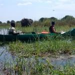
In the Lower Zambezi Valley we stayed in the Kiambi Safari campground from where we did a canoeing safari. It was really beautiful and one of the best “game drives” we had. The canoes get pulled up river by a motorboat and then you paddle back with the current. You move so quietly and calmly that you’re a much less disturbance for the nature then with any other vehicle we had so far. That way you see a lot of animals and can get quiet close to them. Except for the hippos, we were very clad that our guide stopped us several times from cruising straight into a hippo group or between them and the deep water. Because that’s where they want to hide and if you’re in the way to their save spot they will come for you, luckily we weren’t 🙂
that’s Guisela, she was just a seconod away from joining us
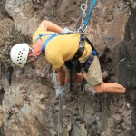
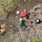
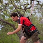
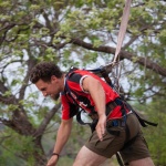
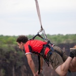
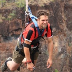
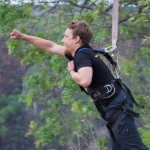
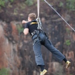
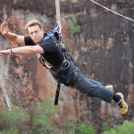
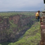
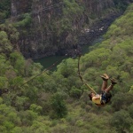
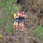
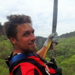
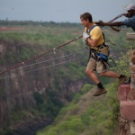
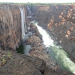
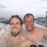
The next and unfortunately already last step on our Zambia tour was Livingstone, the zambian town next to the Victoria Falls. The falls are situated directly at the border to Zimbabwe and it is possible to visit them from both sides. The sight on the falls is much better from the zimbabwean side especially out of the rain season. That’s why we decided to do some fun activities in Zambia before we go dribbdezambezi to have a good look at the falls. They have a huge range of activities that are all going to kick up your adrenalin level e.g. white water rafting, bungee jumping, kayaking, climbing and so on. David and I went for a whole day to the Gorge, Topher joint us but didn’t wanted to do the deeds, because of a lack of height tolerance ;). We started with almost 100 m abseiling (yes, that‘s how they call letting you down on a rope) at first with the face towards the mountain like you would do after a climb. The second time you do it face down, that enables you to enjoy the view down the cliff while you descent.
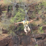
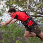
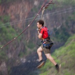
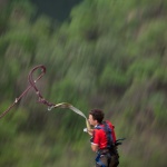
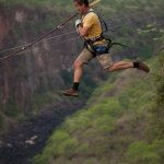
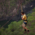
Next was the zip line superman, where you are attached to a wire that spans from one side of the gorge to the other. Now you run as fast as you can (the faster the wider you will go) towards the cliff and then slide along the wire over the gorge. That one isn’t too thrilling but you get a great view.
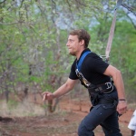
Topher got a superman run for free, look how happy he is 😀
Captain Topher is here to help you
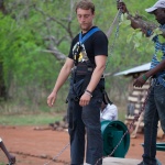
That was our saftey instructor
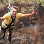
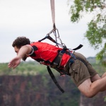
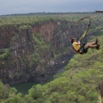
The highlight of the day was the gorge swing. Here you jump of the edge of the gorge and fall for 50 m before the safety wire spans and you begin to swing through the gorge. What a big fun that was. While falling you forget to breath and when your swinging your body is flushed by endorphins so that you’re smiling like a sloth on drugs.
do I really want this to happen…
For our last breakfast in Zambia Topher and I went to the devils pool. It is a natural pool in the middle of the Victoria Falls, right at the edge where the water drops down over 100 m. It can only be used while the Zambezi has a low water level, otherwise you would just get flushed down. It’s not cheap, they charge you 90 $ for a swim and a 5 star breakfast (you had to watch out not to inhale the whole thing accidentally). But it was really cool and it’s a thing you only do once in your life… well I’ve heard that before 😉
@ Devils Pool
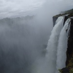
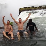
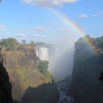
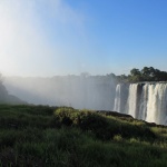
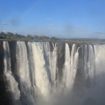
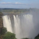
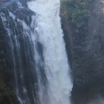
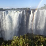
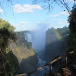
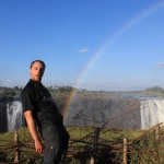
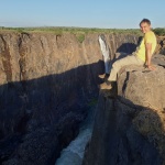
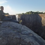
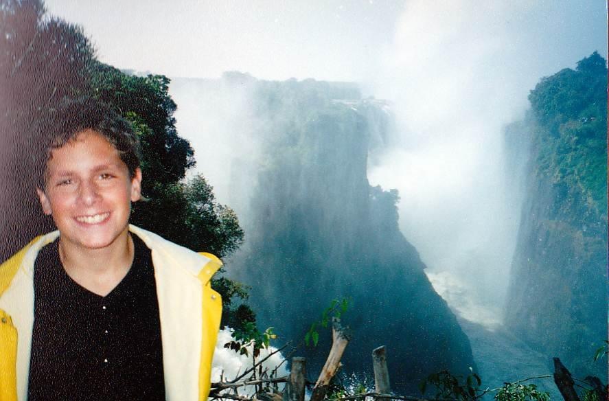
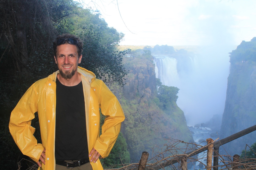
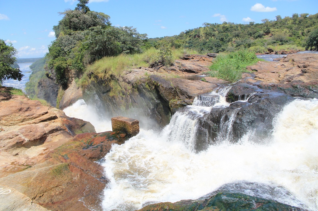
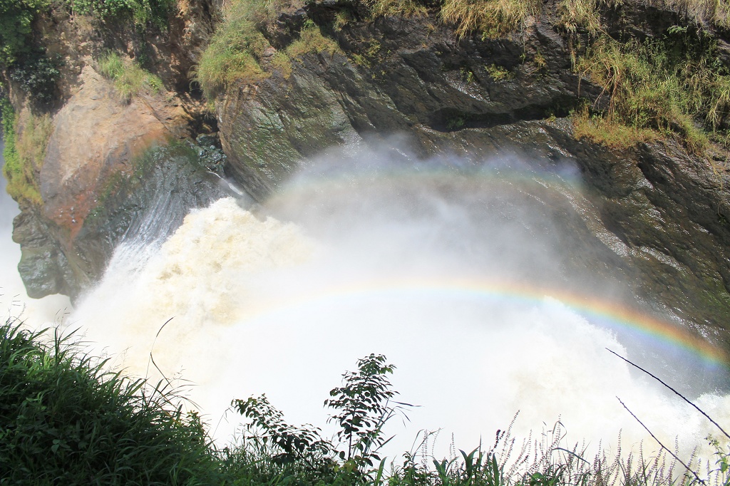
The border crossing to Zimbabwe was a bit annoying, because the zimbabwean officials wouldn’t accept our insurance, the COMESA yellow card. They told us that it was only valid for vehicles that belong to one of the countries that take part in the yellow card, but not for foreign vehicles… After 2 h hours sitting and discussing with the station boss we had no choice but to buy a new insurance for Zimbabwe. Finally we made it dribbdezambezi and reached the town of Victoria Falls. They also have lots of possibilities to make your heart beat faster. The town is much more commercial then Livingstone, in fact it was artificially build just for the tourism of the Vic Falls. Never the less it’s the first place we went since we are in Africa that I’ve already been to 🙂 about 17 years ago. The Falls are amazingly beautiful even now in the dry season when there is not too much water coming down. But just have a look for yourselves.
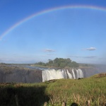
I thaught it was a pot of gold you find at the end of a rainbow…
almost nothing has changed 😀
P.S.: Stay tuned we’re really trying to catch up with the blog but there is just too much happening all the time. And they have lots of really good beer down here, someone’s got to help them with that. Especially as a german you’ve got a high reputation regarding that and therefore it’s the responsibility for our beloved father and/or motherland and every single one of you to keep those extraordinary standards up. Prost!
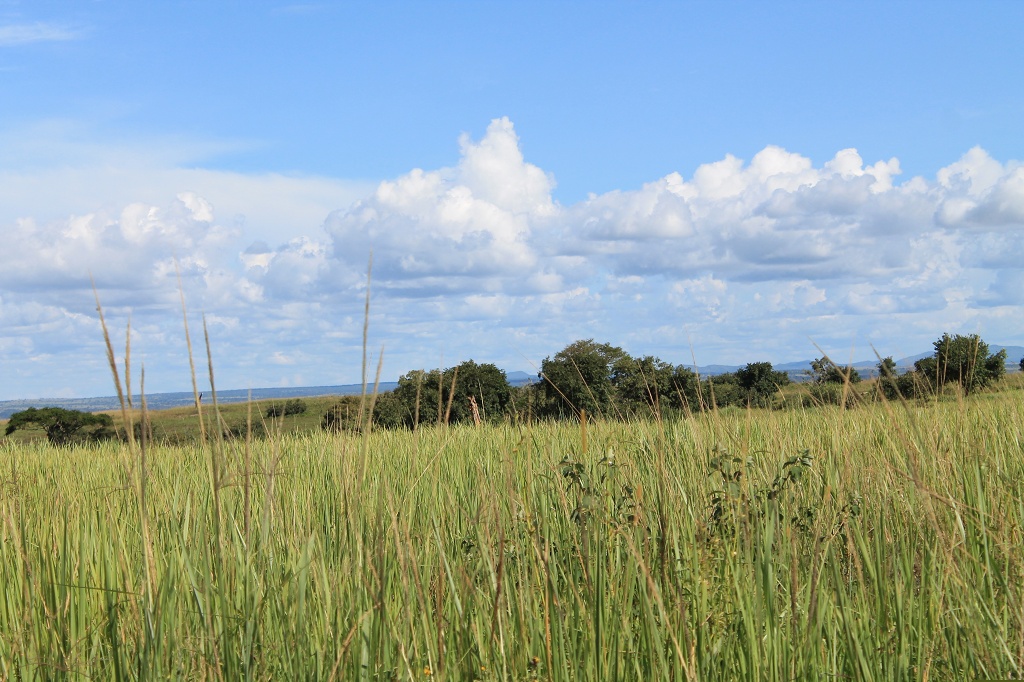
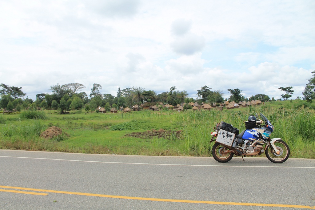
From Kampala we were heading north to see the Murchision Falls. The road was perfect tarmac and we could do the ca. 400 km in one rush. On the way we came along the Karuma Falls. They are directly next to the street, so nothing to pay here, and you even cross a bridge from where you have a really good view. We entered the Murchison national park with our bikes, which is allowed, but they charge you 40 $ per person and 30 $ per bike… but it was fun to ride there. The park is quite different to the last two we visited. It has not so much wild life and seems kind of quiet and asleep. A big part of the road is surrounded by 2 m high grass, so we drove standing to get a look at the landscape and the animals.
After a while a car came from the behind and when we gave way to let it pass it stopped and we heard a cheerful “Hey Deutsche in Uganda”. That was Ingbert, he works for the Cap Anamur and was on a short trip to the falls, so we joined forces ;). Since we entered the park from the Tangi Gate in the north we had to take a ferry across the Nile to get further south to the view point of the falls. Ferries a somehow always fun to take with a bike.
We stayed the night in the Red Chili campsite (yes, it belongs to the Red Chili in Kampala) and had a really boozy evening with Ingbert and some third-generation-indian ugandan guys. Late in the night there was a little agitation, cause a hippo was standing in the middle of the camp. So we got quiet and took a cautious look, these ones can be quiet dangerous. The next day was very hot and on the way to the falls there were hundreds of tsetse flies on the road. Whenever we wanted to stop or to get a little bit slower these pearls of mother nature were trying to eat us up alive. That was especially unpleasant, because the road condition wasn’t that good anymore. But we reached the falls with only a few bites and they were amazing. The power with which the Nile goes through this narrowness is just unbelievable.
South of the falls the landscape changed again and suddenly we were driving through a (rain)forest from a fairytale. It was so beautiful with butterflies of every color all over and some hawks flying directly in front of us. At some time we were wondering why there are so many cables spanning over the road. Then we saw the spiders, which had the sizes of a small hand… well why not drive a little faster, keep the head down and the visor shut.
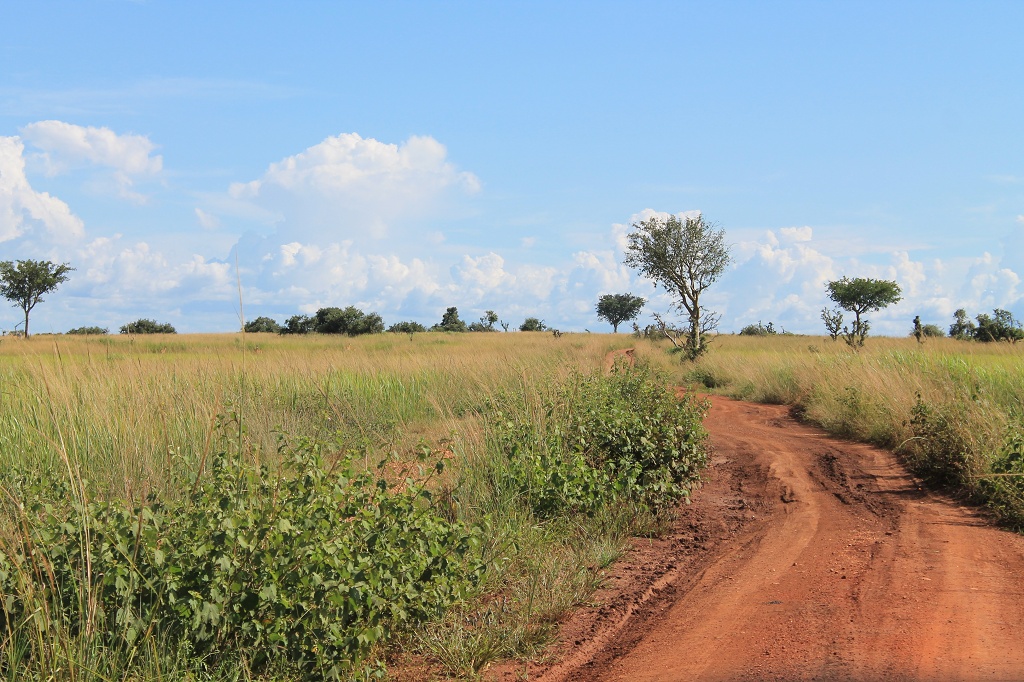
When we left the park we had two options to reach Fort Portal, take the direct dirt road or take the tarmac back to Kampala and from there to Fort Portal. We went for the dirt road, but after 10 km it started to pour down like in a rain forest 😉 The red dirt roads get very slippery when wet so we turned back and drove the 500 km tarmac.
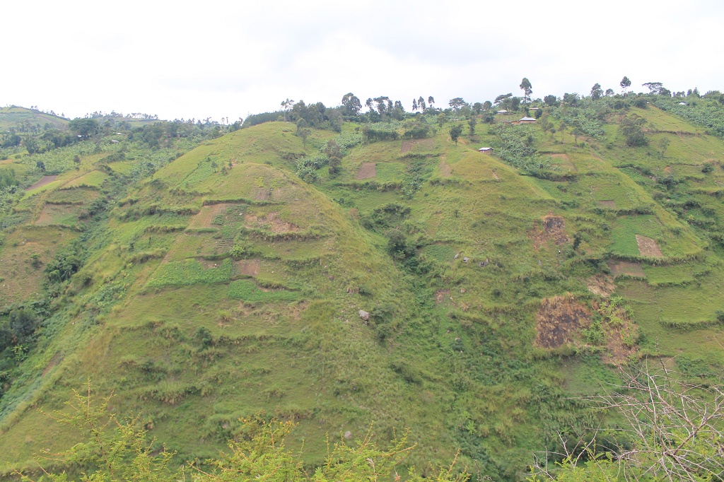
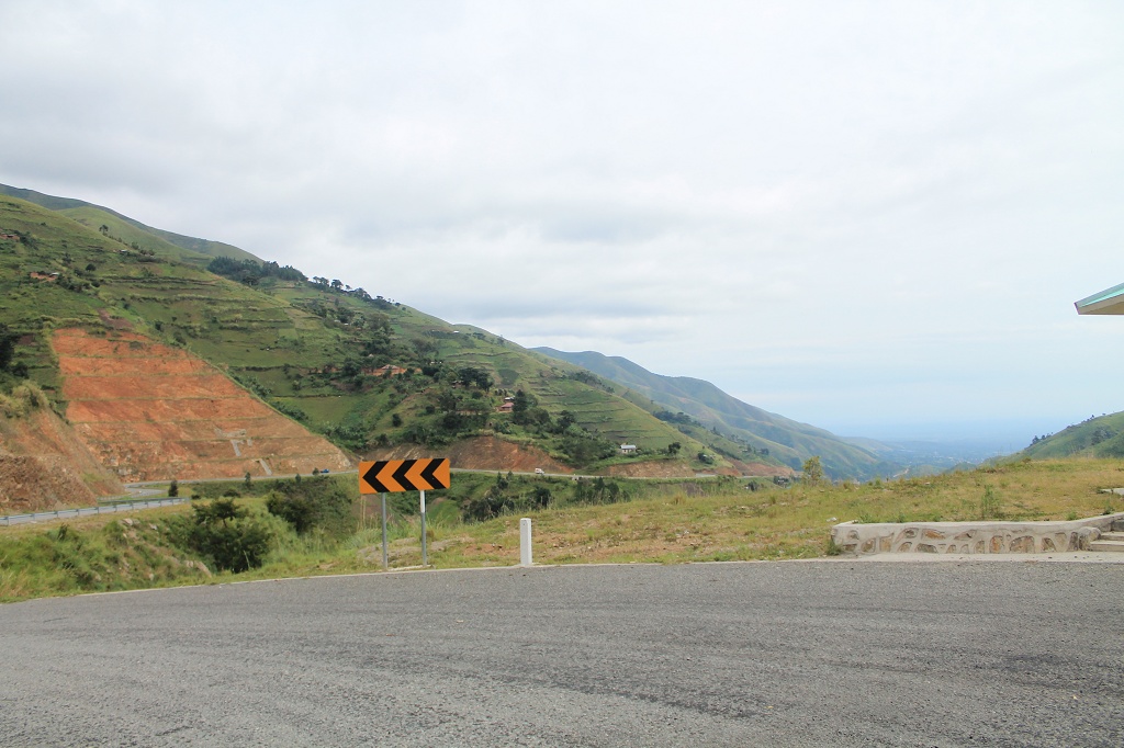
From Fort Portal we did a fabulous day trip to Bundibugyo and back. Just to enjoy riding the beautiful mountain road and passes over the Ruwenzori Mountains and to have a look at the breathtaking landscape and had a look into DR Congo.
obviously size does matter some times
The next day we started south and crossed the equator for the third and last time of our trip. After an overnight stay at a camping site in the Queen Elisabeth national park we headed on direction Kisoro, passed it and reached Cyanika, the border town to Rwanda. The road to get there was again great fun to ride, with countless curves.
Heavy thinking with some biltong
The crossing was quite easy and the customs officer could fix the mess with the carnets his colleague had done when we entered Uganda. We were a bit nervous because we had heard it is not allowed to bring plastic bags to Rwanda and that they would search for them at the entry. Nearly everything we transport is wrapped in a plastic bag. But no one wanted to have a look at the bikes, they even didn’t check the chassis numbers. The only new thing was, that they took our temperature and asked if we’d been to west Africa…
We went on to Ruhengeri, it’s about 25 km from the border. Here in Rwanda the streets are full of people walking on the road again. You find much less cars and boda bodas than in Uganda or Kenia but more bicycles. The traffic is quite moderate and it seems that they stick to some rules, which we can’t remember anymore ;). So far Rwanda has been really lovely from the beginning. The landscape is still tremendous and everything feels very friendly. We stayed the night at the Red Rocks backpackers inn and campsite (redrocks-rwanda.com). It’s a cool place with super delicious food you’ll have a great time when you go there. Unfortunately we had to move on the next day to Kigali the capital of Rwanda.
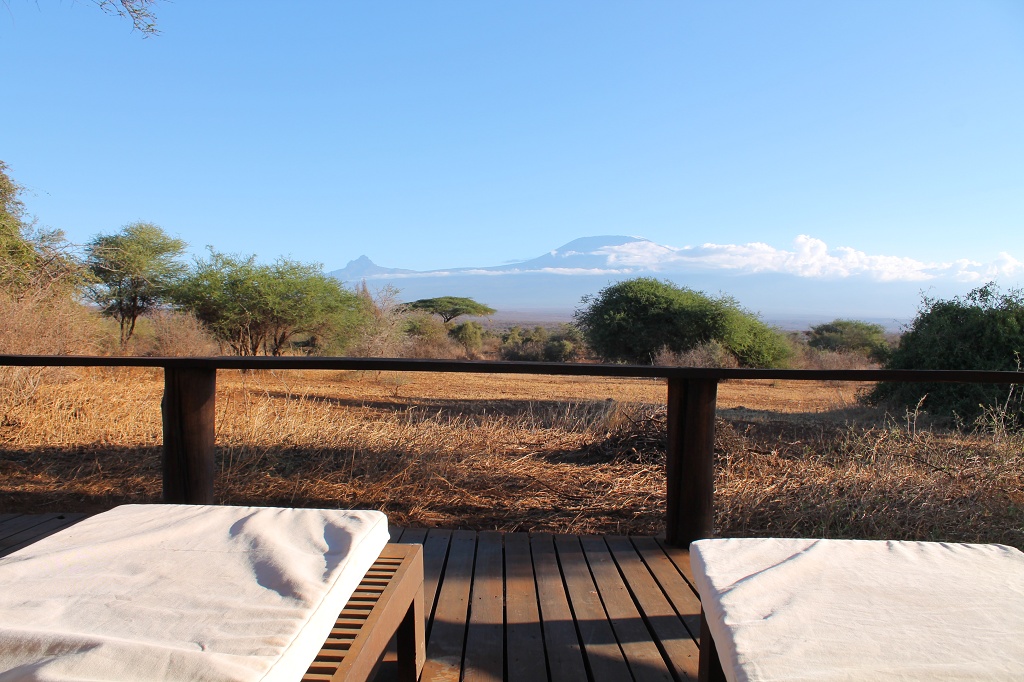
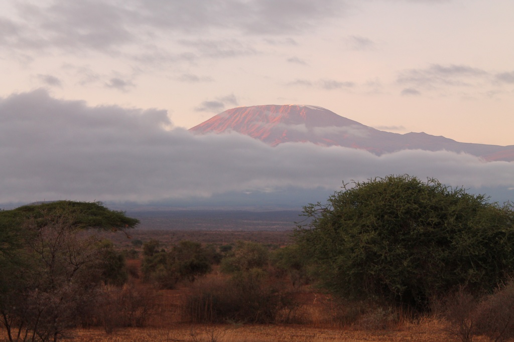
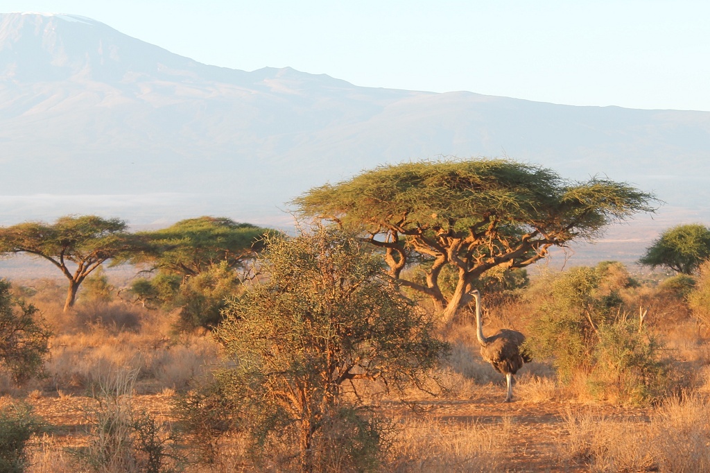
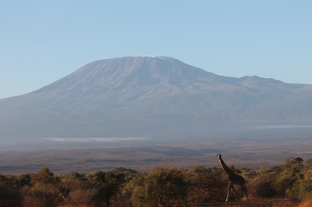
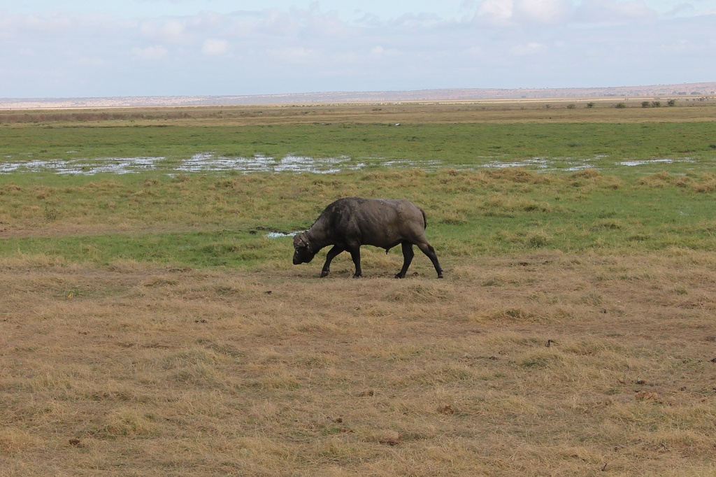
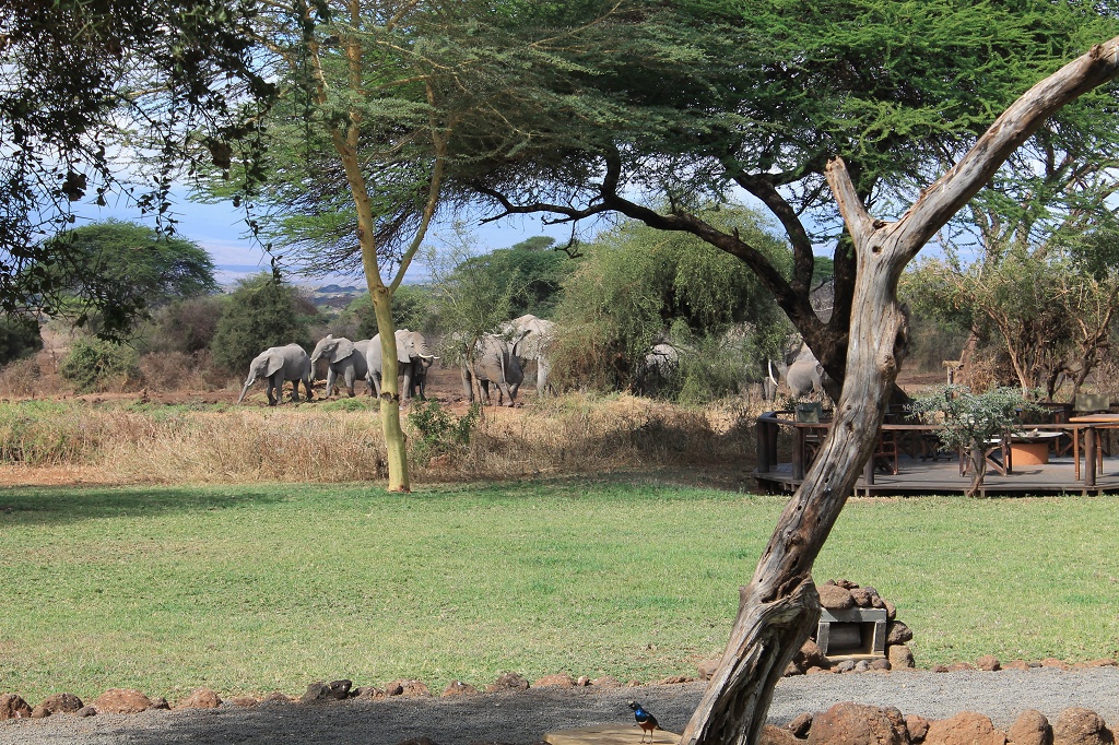
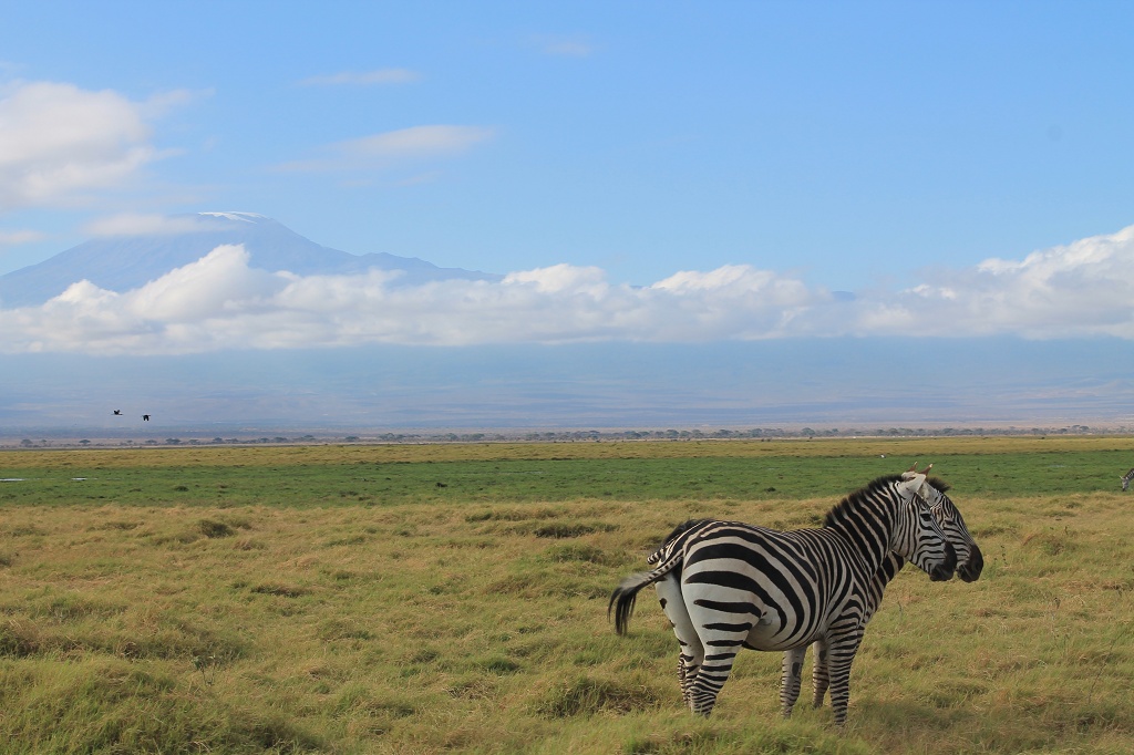
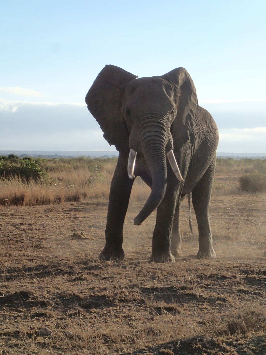
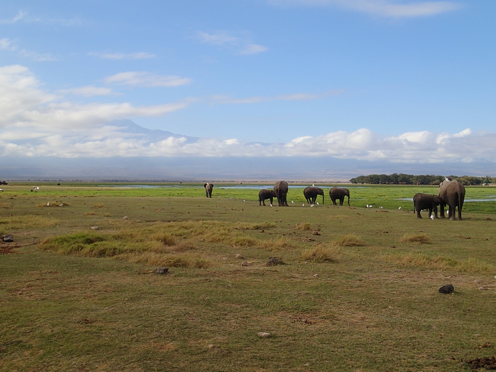
We stayed the night at the wonderful Tawi Lodge near the Kimana gate at the north east part of the park. Here you have a wonderful sight over the Kilimanjaro, from everywhere … even from the toilette :). It’s a very beautiful place to be and we enjoyed every moment in this piece of paradise.
Kilimanjaro
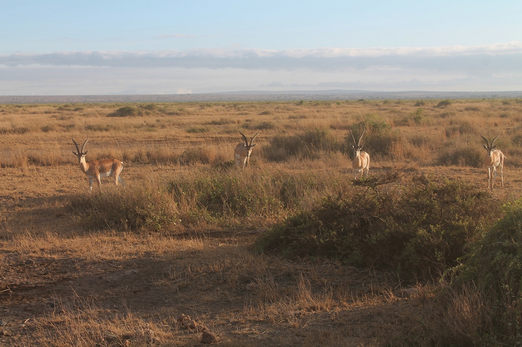
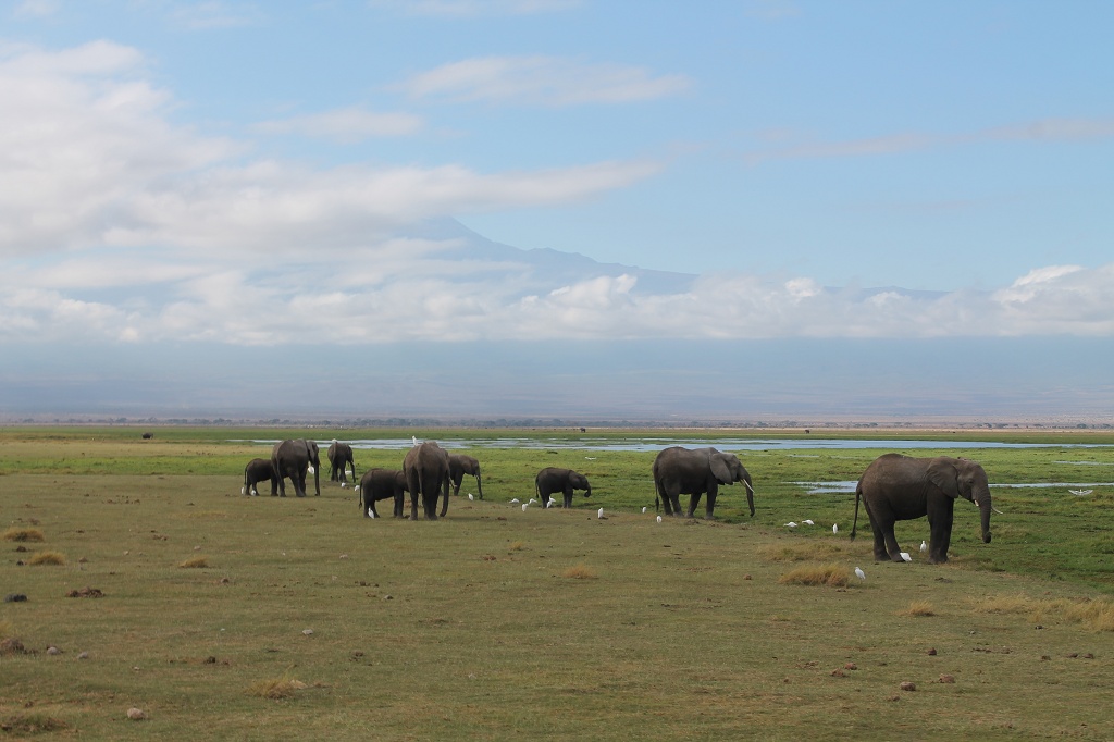
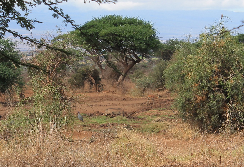
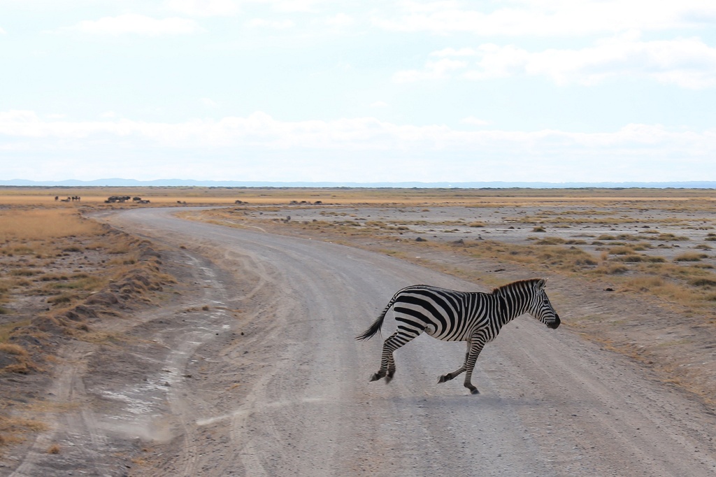
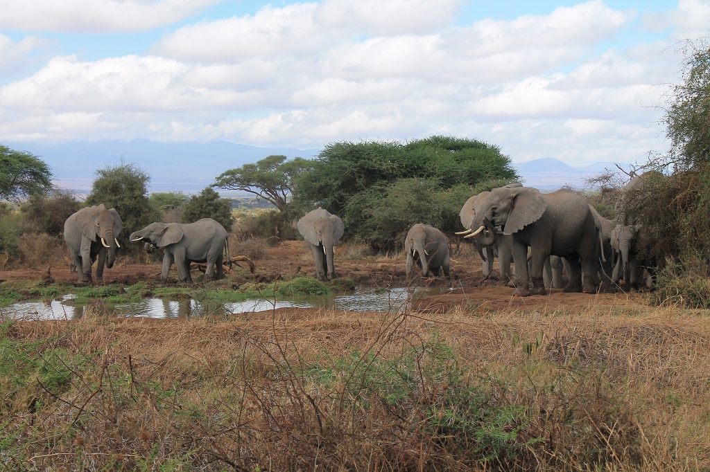
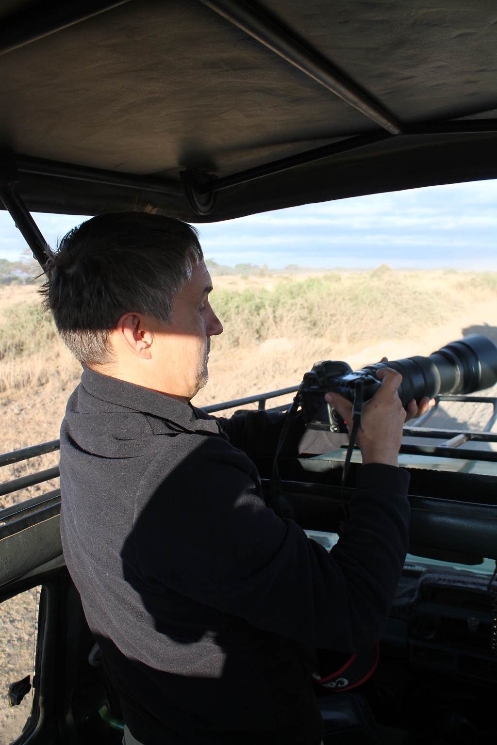
As you know we already paid the entrance fee for the Amboseli national park, so why not go for a real and legal game drive in a 4×4 😉 That’s what we did the next morning and it was good fun. You just can see a lot more when you’re not riding a bike and don’t have to watch the street 😉
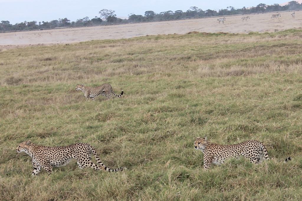
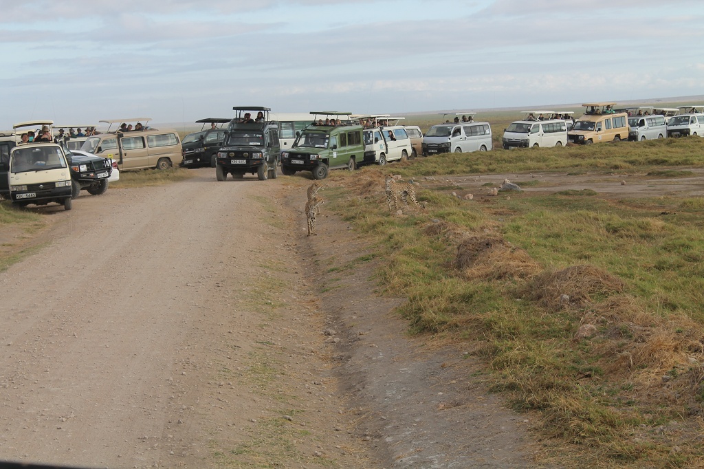
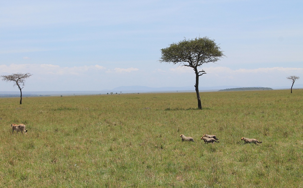
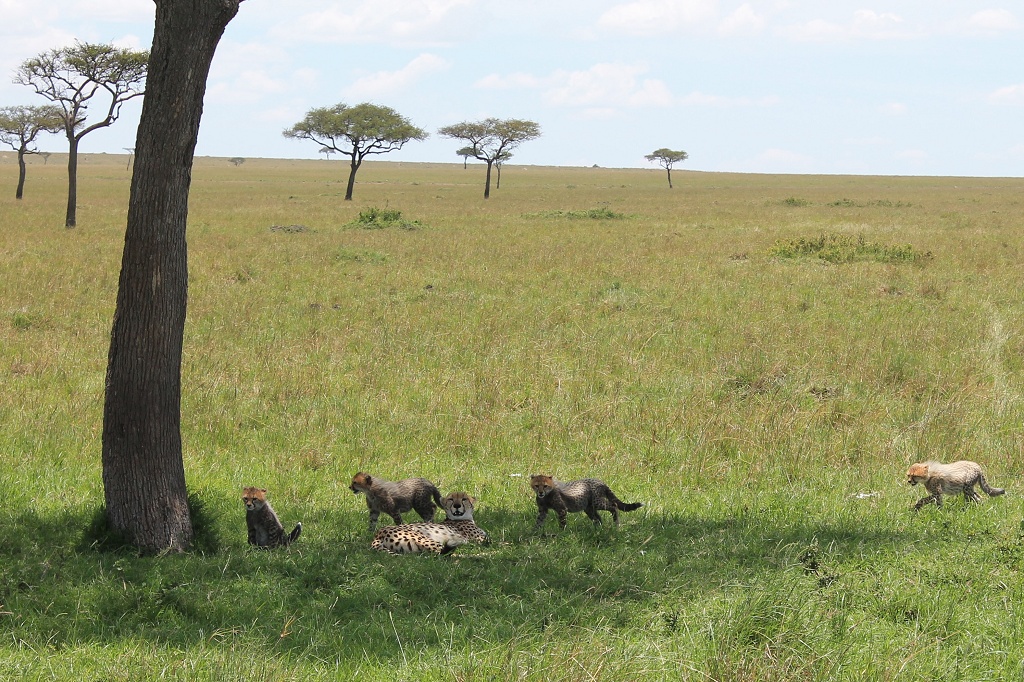
Cheetas and a few tourists
pure elegance
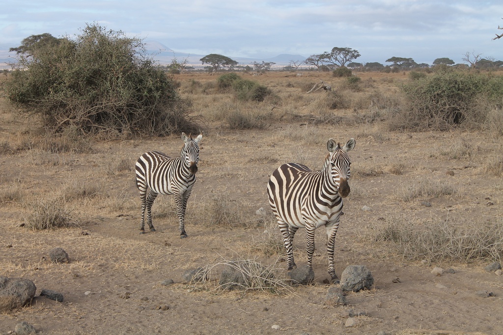
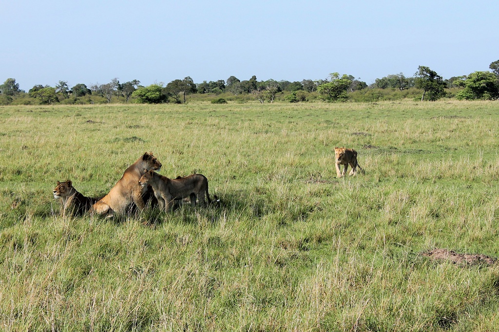
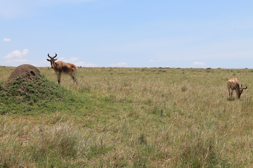
two lions … really
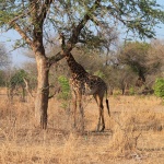
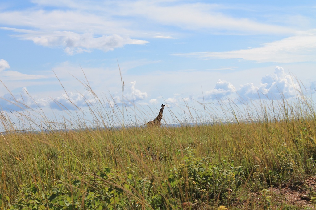
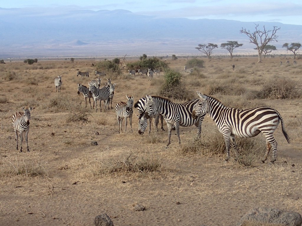
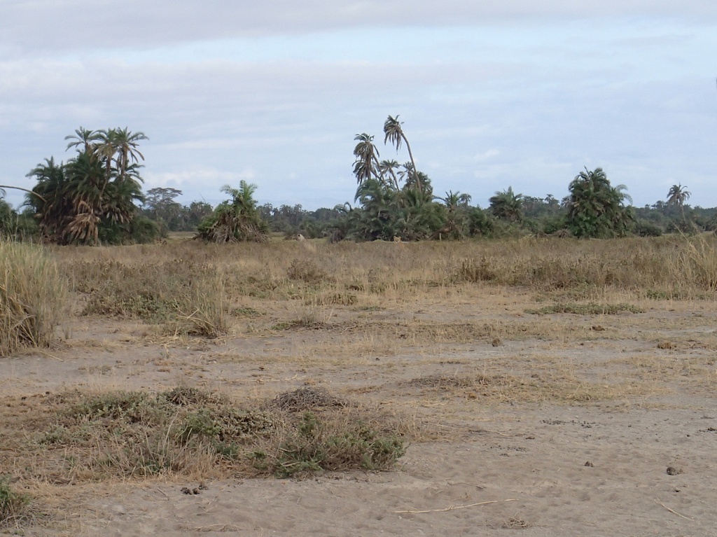
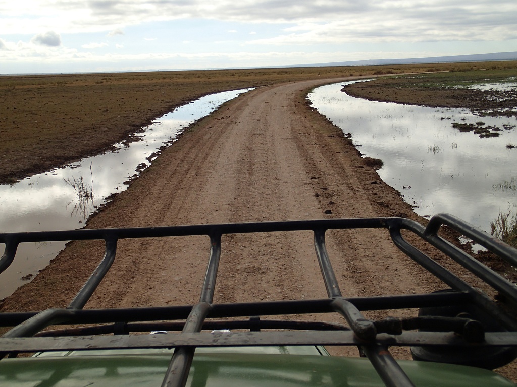
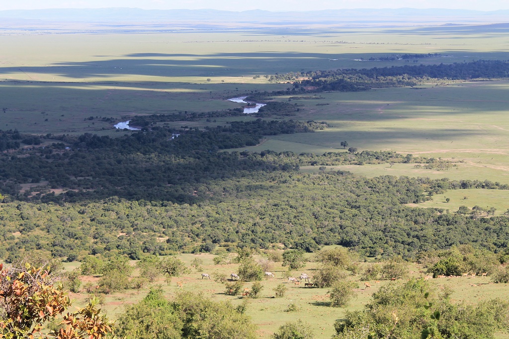
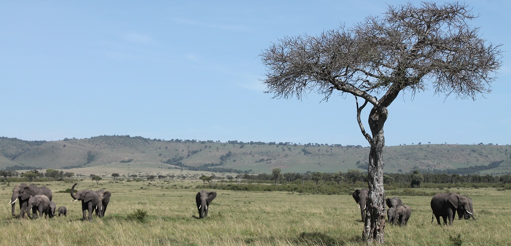
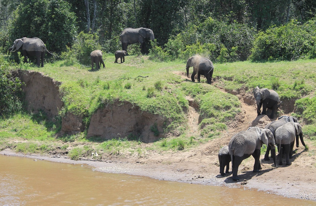
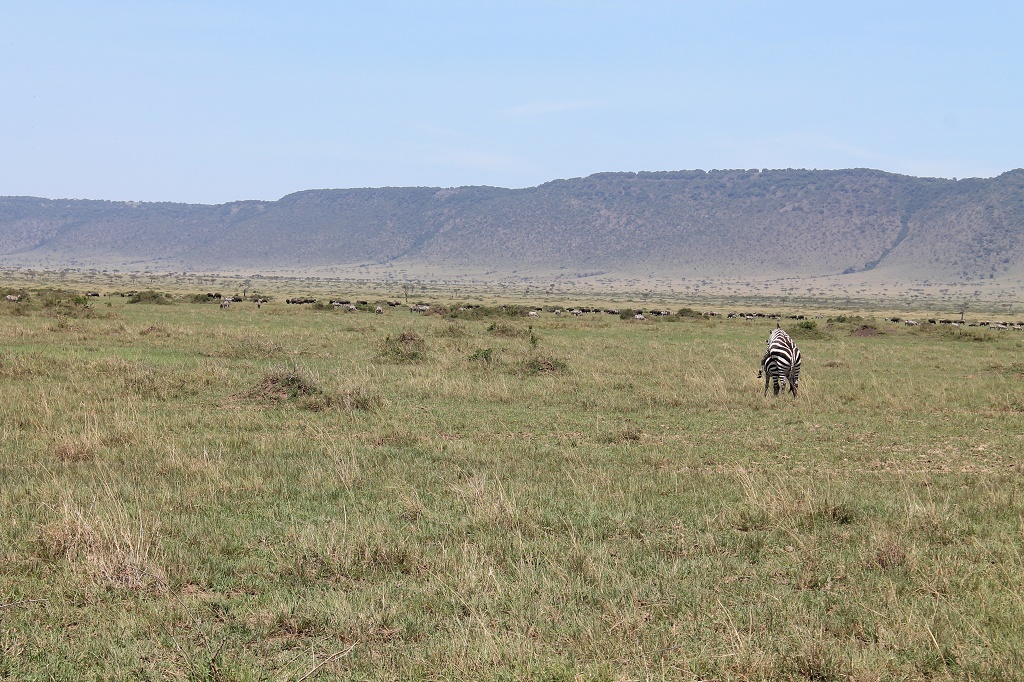
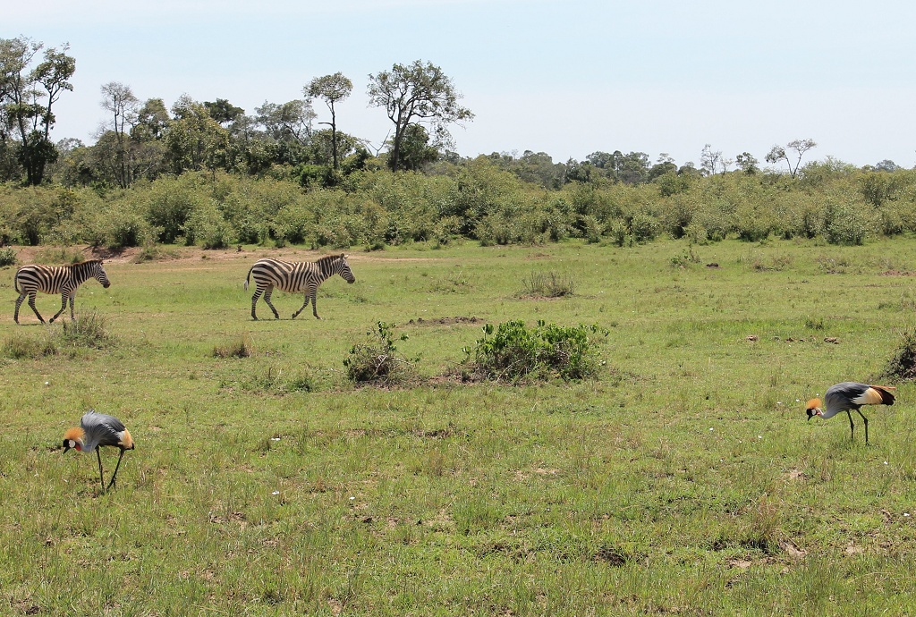
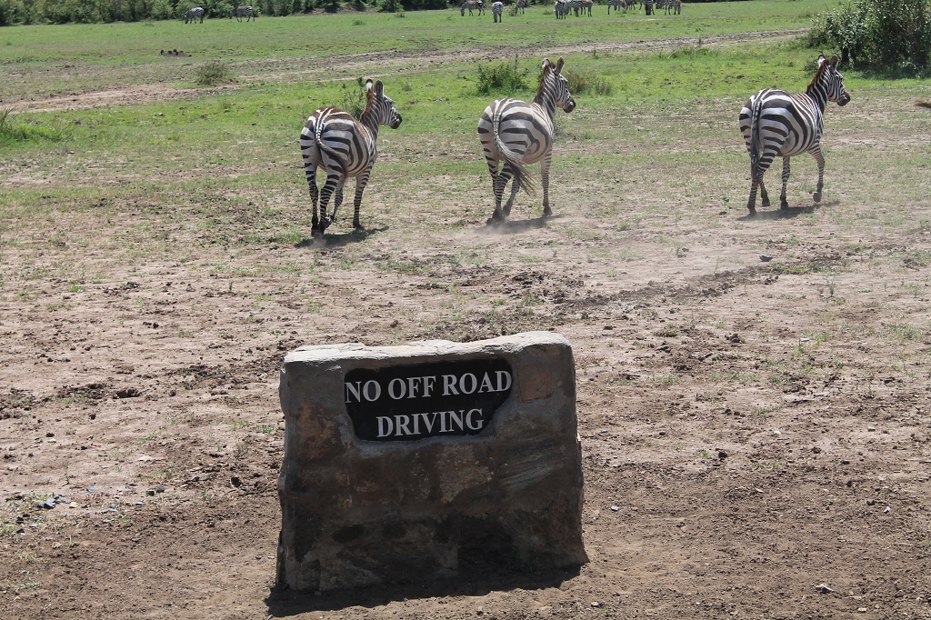
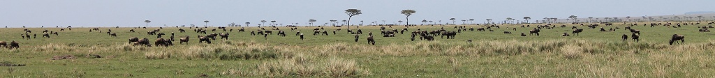
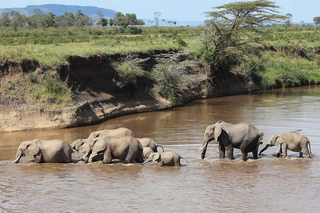
Happy and flashed from all the wild life we went back to the jungle junction in Nairobi to pick up our luggage and to stay for another night before head on to the lake Victoria. We heard that the Maasai Mara national park, which we would pass anyway, would be even more fascinating. So we decided to go there and to take Axel’s offer and visit his second lodge, the Kilima Camp. And what should I say it was tremendous. The lodge itself is situated on a cliff so that you have an amazing view over the Maasai Mara plane. This time we pitched our tents and were allowed to use the shower and toilette of one of the big bungalow like tents.
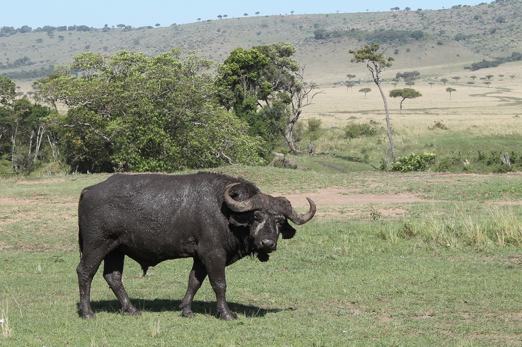
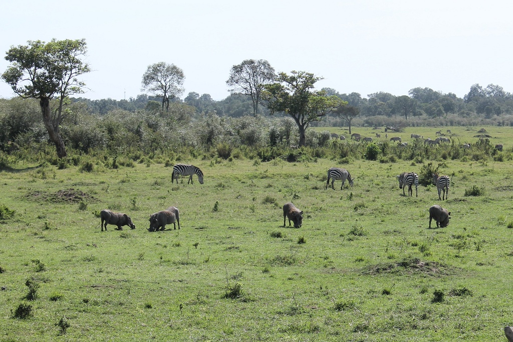
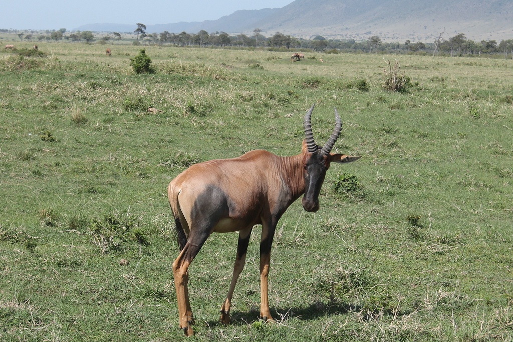
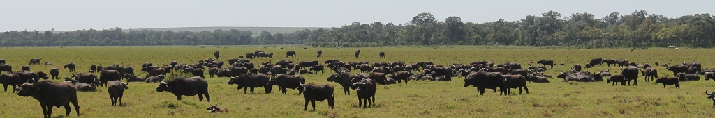
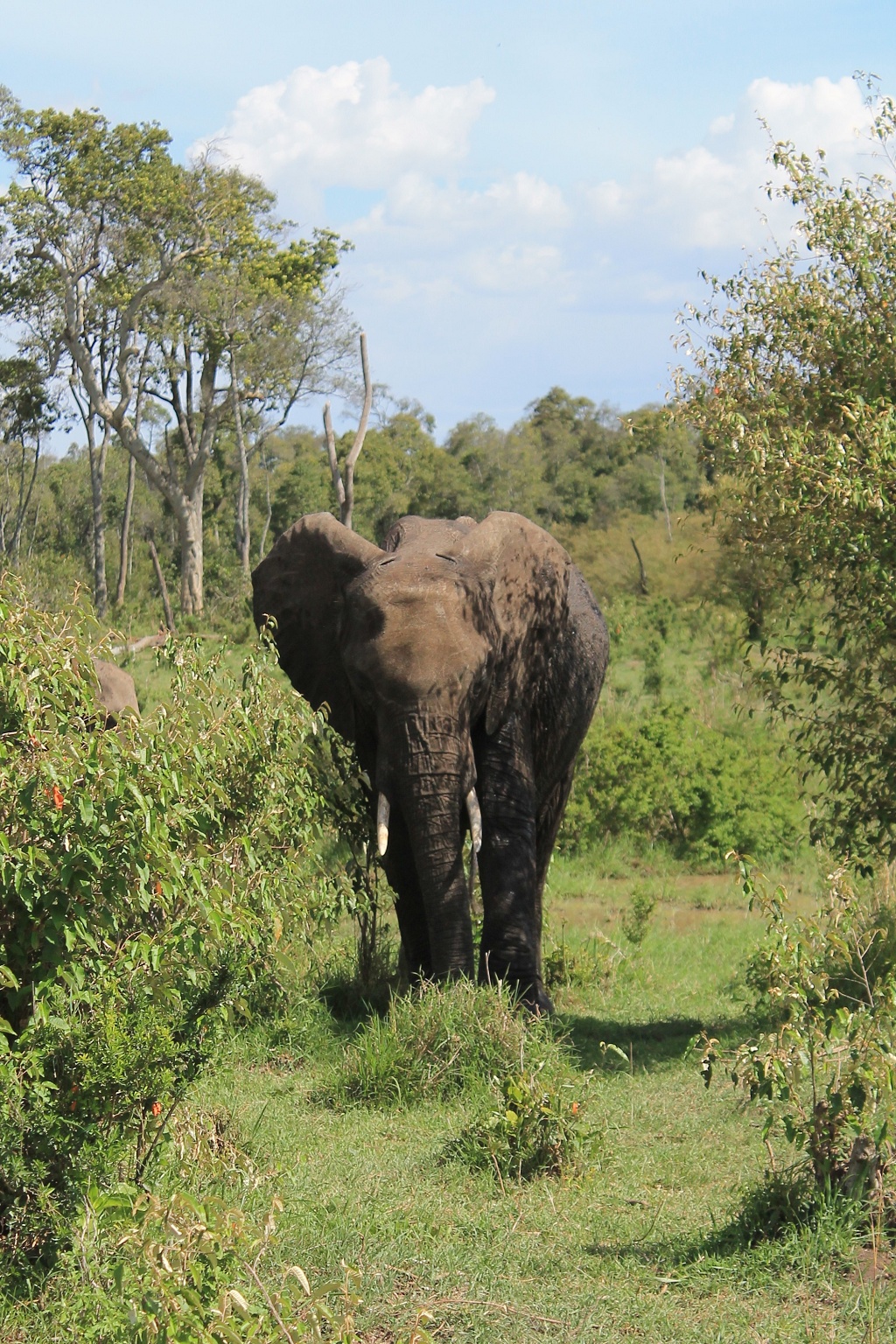
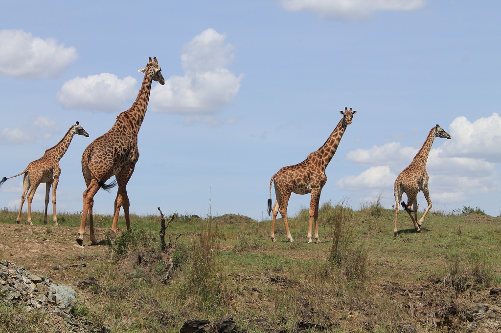
We went for a full day game drive and were so lucky. The Maasai Mara is the kenian part of the better known Serengeti (Tanzania). And just now the migration took place. It’s the biggest migration of land living animals in the world, so they were all over the place.